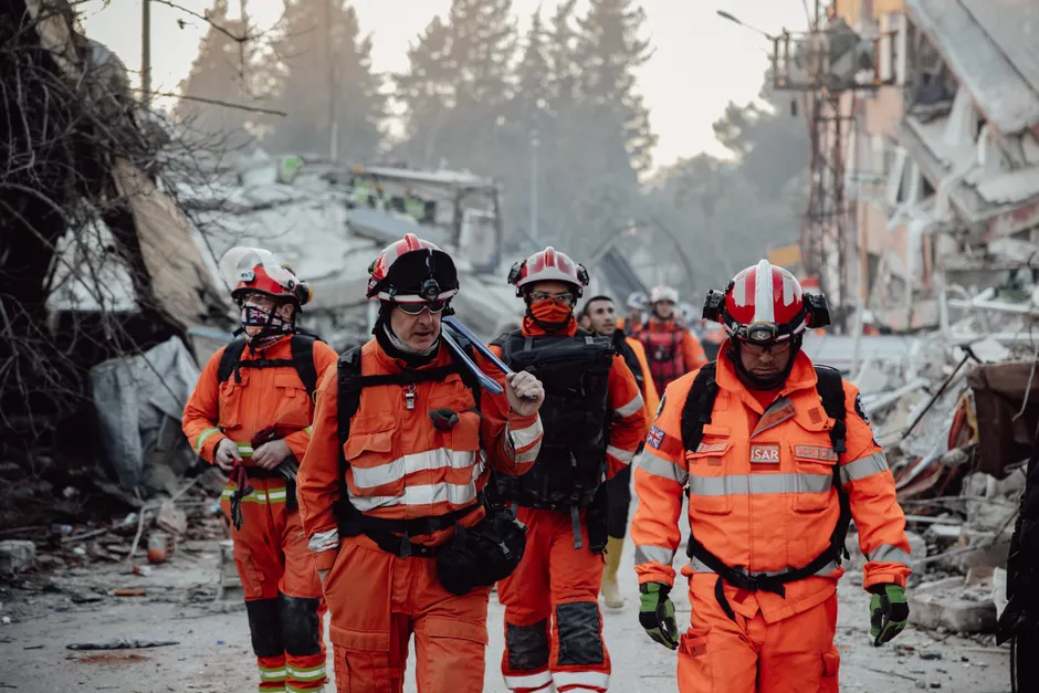
Magnitude 7.4 Earthquake Strikes Western Colombia, Killing at Least 82

A magnitude 7.4 earthquake struck western Colombia on August 10, 2026, with its epicenter in San José del Palmar, Chocó, killing at least 82 people and causing serious damage across the Pacific coast region. The Servicio Geológico Colombiano (SGC) recorded the event at 07:34 local time (12:34 UTC) at a depth of 103 km, located at 4.99°N, 76.29°W, and described it as the largest-magnitude seismic event registered in the country. (SGC)
Reuters reported that at least 77 people were killed in the quake, with 42 deaths occurring in a single affected locality, the highest toll among the areas hit. (Reuters) The Guardian's live blog, also citing Reuters, placed the confirmed death toll at 82. (The Guardian) Earlier in the day, the same live blog documented a rapidly climbing count: from 20, to 22 after an official revision, to 47, to more than 70, and finally to 82, reflecting the fluid nature of casualty reporting in the immediate aftermath of a major seismic event.
The BBC reported at least 21 killed, citing local officials, a figure consistent with the earliest stages of the toll count before later updates. (BBC)
The SGC reported a magnitude 4.8 aftershock at 08:18 local time (13:18 UTC), also centered near San José del Palmar at 4.87°N, 76.39°W, at a depth of 94 km. The proximity in time and location is consistent with aftershock behavior following a large-magnitude mainshock, though the SGC has not formally classified it as such.
The earthquake's depth of 103 km places it in the intermediate-depth range, characteristic of the subduction zone dynamics along Colombia's Pacific margin, where the Nazca Plate descends beneath the South American Plate. This tectonic setting has produced some of the region's most destructive events. The largest earthquake ever recorded in Colombia was a magnitude 8.8 quake on January 31, 1906, with its epicenter on the Colombian Pacific coast, which generated a tsunami. (SGC)
The SGC's Visor Sismos seismic viewer recorded an additional earthquake of magnitude 2.0 or greater in Colombia on August 5, 2026 at 2:30 p.m., located at 4.62°N, 73.82°W. (SGC) The agency also reported several other regional events in the days surrounding the mainshock: a magnitude 5.5 earthquake in the East-Central Pacific Ocean on August 10 at 00:41 local time (05:41 UTC), nearest to the Galápagos Islands, Ecuador; a magnitude 4.6 earthquake in Satipo, Peru, on August 9 at 10:40 local time (15:40 UTC) at 95 km depth; and a magnitude 3.8 earthquake on the Venezuela-Colombia border region near Herrán, Norte de Santander, on August 9 at 12:57 local time (17:57 UTC) at superficial depth.
Separately, the SGC issued extraordinary activity bulletins for the Puracé volcano, part of the Los Coconucos volcanic chain, on August 8, 9, and 10, 2026. The volcano remains in an alert state, affecting the departments of Cauca and Huila. While volcanic and seismic activity along Colombia's Pacific margin are both driven by the same subduction processes, the SGC has not linked the Puracé bulletins to the August 10 earthquake.
The SGC operates an online portal (sismosentido.sgc.gov.co) through which the public can report felt earthquakes, enabling the agency to evaluate seismic intensity, a measure distinct from magnitude. Magnitude, as the SGC defines it, refers to the amount of energy released by an earthquake and is a physical measure based on seismographic records. Intensity, by contrast, reflects the effects of shaking at specific locations and is gathered through observational reports.
The broader context here is Colombia's persistent exposure to high-magnitude seismic events along its Pacific margin. The 1906 magnitude 8.8 event and the current 7.4 quake both originate from the same tectonic engine. While the 2026 event did not generate a reported tsunami, its intermediate depth likely attenuated surface shaking relative to a shallower event of comparable magnitude, even as it spread energy over a wider felt area. The death toll of at least 82, concentrated heavily in a single locality according to Reuters, underscores the vulnerability of infrastructure in Chocó, one of Colombia's most under-resourced departments. The simultaneous volcanic alert at Puracé adds a layer of complexity for Colombian disaster management authorities already stretched by the earthquake response.
Casualty figures remain evolving. The trajectory from 21 to 82 confirmed dead across a single day illustrates the lag between seismic events and verified reporting in remote, mountainous terrain where communication infrastructure is fragile. Further revisions are likely as search and assessment operations continue.