Digital Twins of Shackleton's Quest and Scott's Terra Nova Emerge from the North Atlantic Depths
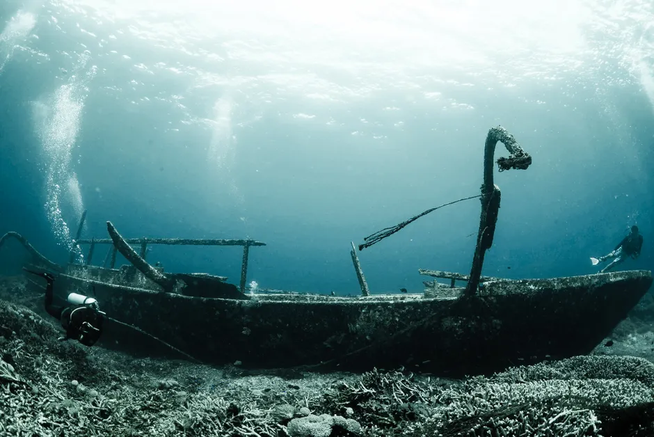
A Royal Canadian Geographical Society (RCGS) expedition has produced detailed 3D digital twins of two shipwrecks central to the "Heroic Age" of polar exploration: Ernest Shackleton's final vessel, Quest, and Robert Falcon Scott's Terra Nova The Guardian. The 21-day mission, dubbed the 2026 Heroic Age Expedition, departed Woods Hole Oceanographic Institution (WHOI) in Massachusetts on July 2 and was led by RCGS chief executive John Geiger Canadian Geographic.
The team used Alvin, the WHOI-operated submersible that carried the first human crew to the Titanic wreck four decades ago, to dive on both sites The Guardian. Imaging hardware from Canadian firm Voyis captured thousands of high-resolution frames at each wreck, stitched together on site into photorealistic 3D models rather than processed later in a lab. The mapping extended beyond the hulls themselves to the surrounding debris fields, giving researchers a fuller picture of how each vessel broke apart and settled on the seabed Canadian Geographic.
Quest lies more than 1,000 feet (305 metres) down in the Labrador Sea off Canada's coast. It sank in 1962, four decades after Shackleton's death aboard the ship in 1922 — the explorer suffered a fatal heart attack at age 47 while anchored off South Georgia, en route to what would have been his fourth Antarctic expedition. The wreck itself was located only in 2024, in a prior RCGS survey also led by Geiger The Guardian. This year's dive marks the first time researchers have returned to the site to systematically image it, spending three days surveying and mapping the wreck RCGS.
Terra Nova, the ship that carried Scott's Antarctic party south, sank in 1943. Scott reached the South Pole on January 17, 1912, roughly a month after Roald Amundsen's Norwegian team had already done so. Scott and the four men of his south polar party died on the return march. The juxtaposition of the two ships in a single expedition ties together the two figures most associated with the British-led "race to the pole" — rivals in life, now both rendered as high-fidelity data sets on the same survey.
The expedition's stated aim was to document both wrecks without disturbing them CBC. Digital twinning avoids the retrieval or physical disruption that earlier generations of maritime archaeology sometimes required, producing instead a navigable, dimensionally accurate model that researchers, museums and the public can study indefinitely without further intrusion on the site. Smithsonian Magazine, previewing the mission before it sailed, framed it as an attempt to preserve two wrecks tied to rival voyages using the same non-invasive method Smithsonian Magazine.
The technical case for this approach is straightforward enough that it barely needs stating: deep-sea wrecks degrade, currents shift, and access via crewed submersibles is expensive and rare. A digital twin captured once, at sufficient resolution, functions as a permanent record even if the physical site is never visited again. What's more interesting is the choice of vessels. Quest and Terra Nova are not equivalent in fame — Terra Nova's association with Scott's polar tragedy has long overshadowed Quest in popular memory — but pairing them on one expedition puts two competing national mythologies of exploration under the same imaging protocol, treated identically as data rather than narrative.
WHOI's own announcement, issued July 8, focused narrowly on the Quest imaging as the headline achievement of the mission WHOI, while RCGS's release emphasized the technology used to achieve it. The Guardian's July 15 account, the most recent and most complete public reporting on the expedition, ties together both wrecks and both institutional roles, sourcing its detail directly from Geiger and the RCGS team rather than from a journal publication.
No peer-reviewed paper has yet accompanied the release of the imaging data, and neither the Guardian's account nor the earlier institutional statements from WHOI, RCGS or Canadian Geographic indicate a timeline for when the digital models might be made publicly accessible or in what form. That distinction — between an institutional announcement and a peer-reviewed archaeological record — is worth keeping in mind as the project moves from expedition to publication.


