A Big Earthquake Hit Colombia — Here's What We Know

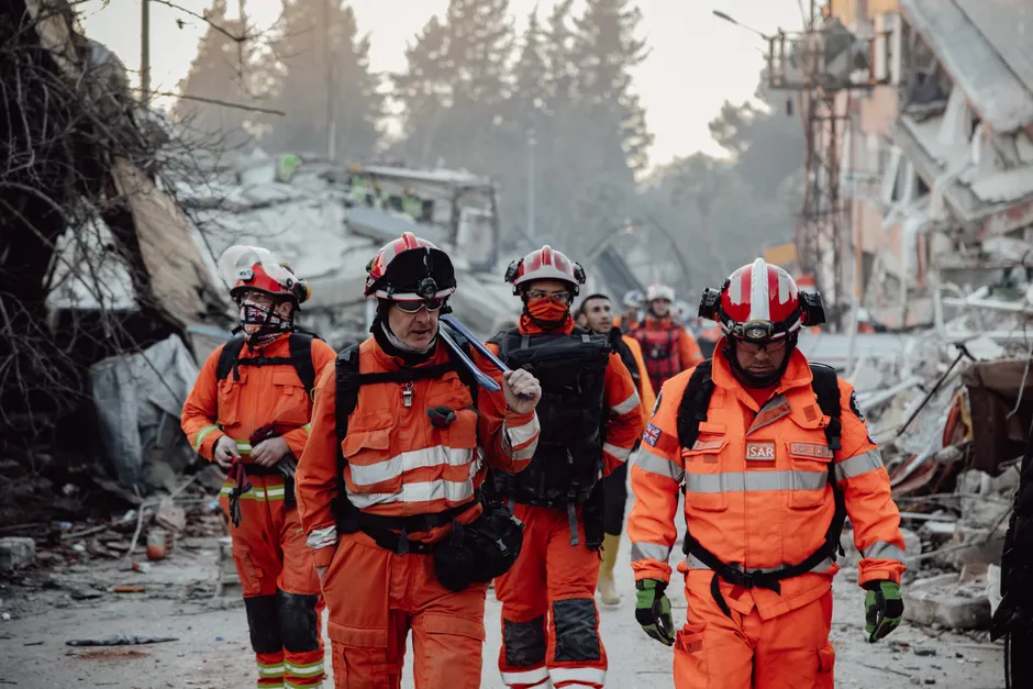
A powerful earthquake struck western Colombia on August 10, 2026, killing at least 20 people and causing buildings to collapse across several cities. The government declared a national emergency and sent rescue teams to the hardest-hit areas.
The earthquake measured 7.4 in magnitude — a way of rating how much energy a quake releases, where each whole number represents about 30 times more energy than the one below it. It struck deep underground, about 107 km (66 miles) below the surface. The shaking was felt across Colombia and even in neighbouring Ecuador.
The US Geological Survey located the centre of the quake 5 km east of a small town called San José del Palmar, in Colombia's Chocó department, about 400 km west of the capital, Bogotá. Colombia's own geological service, the Servicio Geológico Colombiano, first rated the quake at 6.6 before raising the number. The US tsunami warning system said there was no risk of a tsunami — a large ocean wave that quakes can sometimes trigger.
Most of the deaths happened in the Coffee Triangle and the Valle del Cauca regions. In the city of Pereira, 18 people were killed and others remained trapped in collapsed buildings, mayor Mauricio Salazar told Caracol Radio. In Manizales, two people died, mayor Jorge Eduardo Rojas Giraldo told Blu Radio. He said more than 12 buildings and 20 homes were partially or completely destroyed there, and he urged people to stay outdoors because of aftershocks — smaller tremors that follow a big quake and can topple already-weakened buildings. One of the towers of Manizales's neo-Gothic cathedral fell onto the main interior space.
In Cali, mayor Alejandro Eder said at least 20 buildings had collapsed, with people trapped in at least 19 of them. The city asked for extra rescue teams from Bogotá and Medellín. Video shared by local news outlets showed homes and small buildings falling in Pereira, Cali, and Quibdó. Chocó's governor, Nubia Córdoba, reported injuries and serious damage in the regional capital but gave no further details. Six airports were damaged and stopped operating. AFP reporters saw people evacuating buildings in Bogotá.
President Abelardo de la Espriella said he would personally oversee recovery efforts and set up an emergency centre in San José del Palmar. The response is still ongoing, and the death toll may rise as rescuers continue searching through collapsed buildings in several cities.
The broader context here is that Colombia is one of the most earthquake-prone countries in the Americas. The country sits near where two giant slabs of the Earth's crust meet: the Nazca Plate is slowly sliding beneath the South American Plate. When those plates grind and shift, earthquakes happen. Western Colombia sits close to that collision zone, which is why the region experiences so many quakes.
Two earlier disasters help put this event in perspective. In late June 2026, two major earthquakes hit nearby Venezuela, killing more than 6,000 people. In 1999, a smaller but shallower quake near the Colombian city of Armenia killed over 1,100 people. After that disaster, Colombia strengthened its building codes — the rules that govern how buildings are constructed to withstand shaking. The fact that this quake was stronger than the Armenia one but caused fewer deaths may partly reflect those improvements. Its greater depth also helped: a quake that starts deeper underground loses some of its power by the time the shaking reaches the surface. Still, the collapse of the Manizales cathedral tower shows that older buildings built before modern standards remain at risk.
The quake's depth also explains why the damage was spread out rather than concentrated in one spot. A deep earthquake sends its energy outward over a wide area, like ripples spreading from a stone dropped in deep water. That is why people felt shaking as far away as Bogotá and Ecuador, and why damage appeared across Pereira, Manizales, Cali, and Quibdó rather than only at the centre. The downside for rescue workers is that they have to cover a much larger area, which makes the operation harder to coordinate.