Drought and Flood at Once: How England and Wales Got Both in a Single Day
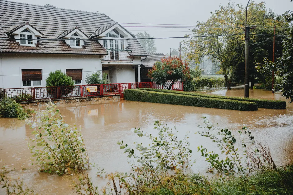
On 27 August 2026, dozens of homes in England and Wales were damaged by flood water after the Met Office issued thunderstorm warnings — a stark end to a summer of five heatwaves that showed how drought and flooding can strike at the same time. The flooding came just as most of England and all of Wales had been formally declared in drought, with 71.3% of England still in drought as of a National Drought Group meeting that morning, according to the Environment Agency (The Guardian).
A yellow thunderstorm warning — the Met Office's lowest-level alert, meaning be aware — covered parts of the Midlands, east of England, south of England, the north-west, Yorkshire and Humber, and Wales until 10pm on Thursday. A second yellow warning for Lincolnshire, parts of the east of England, parts of Yorkshire, Kent and Medway ran from 5pm Thursday to 7am Friday. The Met Office warned that thundery showers could dump up to 75mm of rain in just 12 hours in some areas. A broad band of thunderstorms was forecast to move north across England and Wales, potentially becoming slow-moving through the afternoon and evening, extending into Northern Ireland and southern Scotland.
The flooding hit the West Midlands hardest. Parts of Birmingham saw significant flooding on Wednesday after the Environment Agency issued a flood warning for the Perry Barr area. Seven fire engines attended Wednesday evening after the West Midlands fire service was alerted to flooding at 32 properties near the Tame Valley canal. In Staffordshire, where a lower-level flood alert remained in place, the Environment Agency recorded 60mm of rainfall in 12 hours.
Birmingham resident Ryan Goodwin reported his conservatory flooded with three feet (1 metre) of water and his living room damaged. Goodwin noted that conditions had been so dry beforehand that leaves had blocked drains, and water also ran off the motorway. That detail captures the physical mechanism at work: parched, compacted soils shed rainfall rather than absorbing it, channelling runoff into urban drainage systems and river catchments already stressed by months of deficit.
By Thursday morning, the Environment Agency had issued forty flood alerts across the Midlands, Yorkshire and the south-east. A specific flood alert targeted the River Maun at Edwinstowe and Ollerton in Nottinghamshire, where river levels at the Mansfield The Dykes gauging station were rising rapidly, with Old Rufford Road identified as most at risk. BBC Weather separately reported flooding expected along the Spadesbourne Brook due to rising river levels.
The whiplash from drought to flood is not paradoxical but mechanistically linked. Think of soil like a sponge: when it is damp, it soaks up water readily; when it has been left dry and hardened for months, water slides off the surface instead of sinking in. August had received only 34% of expected rainfall, according to the Environment Agency, following a record-dry July that pushed additional areas of England into formal drought status. The week of 14 to 20 August saw no change to area drought status, with 71% of England by land area remaining in drought. Drought management in England has involved six drought permits (temporary licences allowing water companies to take more water from specific sources) in the north west and Yorkshire, plus one drought order in the north west, according to government data published in April 2026.
Environment Agency chief executive Philip Duffy addressed the juxtaposition directly. "A few days or even weeks of wetter weather cannot reverse the impacts of several months of exceptionally dry conditions," he said. Duffy noted that the yellow thunderstorm warnings show "it is possible to experience simultaneous drought and flood as heavy rain falls on compacted soils."
The broader context here is that the UK's hydrological system is entering a regime where recovery from drought and acute flood risk operate on different timescales, even as they unfold on the same landscape. A single 75mm downpour does not replenish reservoirs or restore soil moisture to levels that sustain agriculture and ecosystems through the following season. It does, however, overwhelm drainage infrastructure, threaten property, and disrupt transport. The drought arithmetic and the flood arithmetic are pulling in opposite directions simultaneously.
Climate scientists have repeatedly warned that global heating is driving more volatile weather patterns in the UK, including intense heatwaves, droughts, flooding and storms. The summer of 2026 delivered five heatwaves before this thunderstorm episode, and the sequence of extremes compresses the interval between distinct hazard types that water authorities, insurers, and emergency services must manage.
For the Environment Agency and the National Drought Group, the operational challenge is now twofold: maintaining drought restrictions and water conservation measures while simultaneously deploying flood response. For residents in the affected catchments, the immediate risk is property damage and disruption; the longer-term risk is that the drought persists beneath the surface even as the headlines pivot to flooding. Duffy's statement is the key analytical anchor here: the compaction of soil through prolonged dryness is what transforms a heavy shower into a flood event, and that compaction does not resolve quickly.
Forty flood alerts, two yellow thunderstorm warnings, and a 71.3% drought footprint for England coexisted on 27 August 2026 — a combination that encapsulates the compound risk profile the UK now faces under a shifting climate.


