Uncrewed Saildrone Circles Antarctica to Measure Ocean Carbon
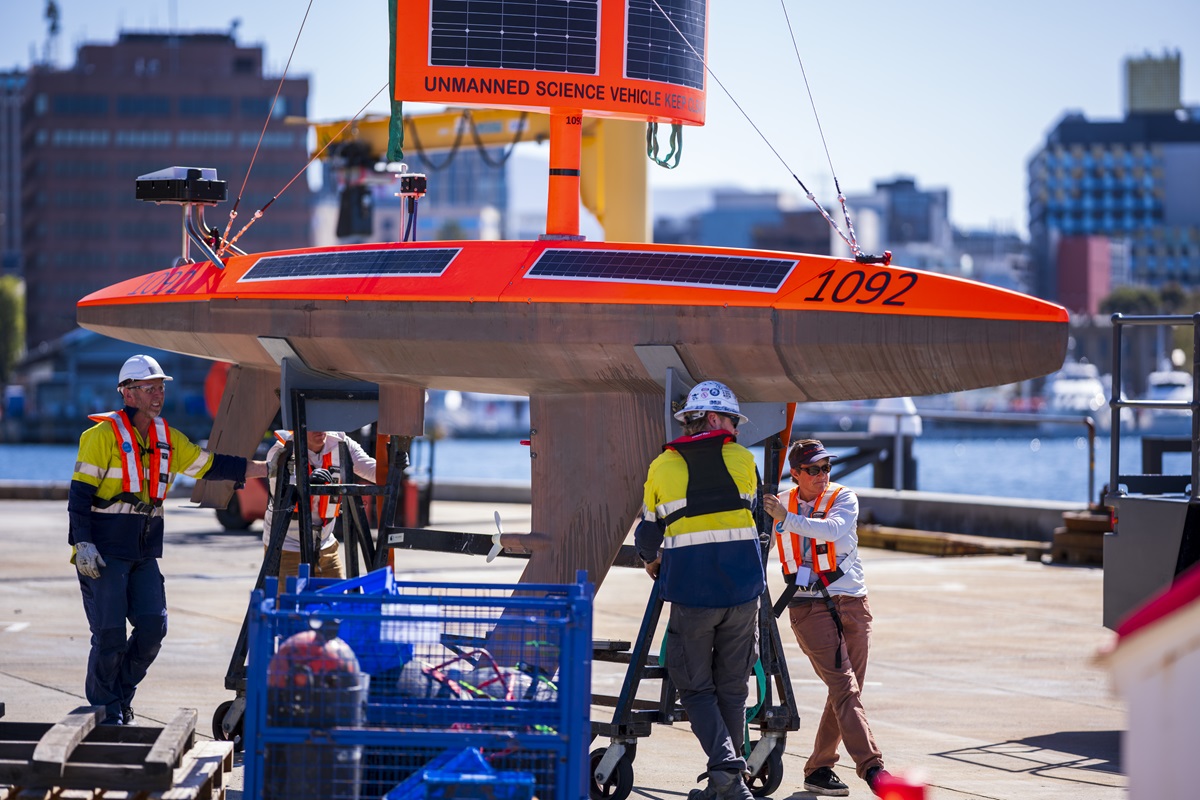
A seven-metre boat with no crew has left Hobart on a 22,000km loop around Antarctica to measure carbon dioxide in the ocean and the atmosphere together. The transit is expected to take seven to nine months. The Guardian
The vessel is Saildrone Explorer SD-1092, built by US maritime company Saildrone. It is propelled by westerly winds and solar energy. A heavy keel keeps it upright, a rudder steers, and a fixed solar sail supplies power. It works a bit like a mobile weather station at sea. Saildrone will monitor it remotely by satellite for the full deployment. Saildrone
The science payload is set for air-sea flux, the exchange of gases between air and water, and upper-ocean state. It will log wind speed, atmospheric pressure, solar radiation, ocean temperature, salinity or salt content, chlorophyll from marine algae, and carbon dioxide in water and air. The objective is to constrain ocean sinks, to narrow estimates of how much carbon the ocean takes up. Dr Elizabeth Shadwick, a principal research scientist at CSIRO, is a scientist on the mission.
The planned track runs east from Hobart toward New Zealand, through the Drake Passage between South America and Antarctica, then eastward past South Africa and back to Hobart. The routing follows the circumpolar westerlies, the strong winds that circle Antarctica. That choice provides propulsion and keeps the vehicle in the core Southern Ocean regime for most of the loop.
The hull is the first in a planned fleet of four, with further launches at three-monthly intervals. The fleet is intended to operate across the Southern, Pacific, Atlantic and Indian oceans, particularly during winter. CSIRO planning material describes Saildrone USVs, uncrewed surface vehicles, deployed every quarter over five years to circumnavigate Antarctica. CSIRO
There is precedent. On August 3, 2019, Saildrone 1020 completed the first autonomous circumnavigation of Antarctica. That 23-foot uncrewed surface vehicle covered 13,670 miles. Saildrone lists the prior Southern Ocean circumnavigation as a 22,000 km, 196-day loop by an uncrewed surface vehicle. NOAA The company reports more than 12 years of operations, more than 2 million nautical miles sailed and 60,000 days at sea.
The broader context here is persistence. Crewed research vessels sample the Southern Ocean in short, episodic visits. Winter coverage is thin. Autonomous surface vehicles do not remove calibration and validation problems, but they can hold course for months without fueling or crew exposure. For carbon accounting, the hard variable is not the mean sink but its interannual variability, shifts from year to year, and seasonal outgassing in winter. Coincident measurements of wind, pressure, temperature, salinity and carbon dioxide in both media allow tighter gas-transfer calculations than atmospheric or surface-ocean data alone.
Looking at what this means for operations, a quarterly cadence would matter more than any single loop. One circumnavigation tests survivability. Four hulls phased at three-month intervals test repeatability. If SD-1092 completes its loop and the follow-on hulls deploy on schedule, researchers would gain overlapping transects across seasons and basins. That would permit comparison of the Pacific, Atlantic and Indian sectors of the Southern Ocean under winter forcing, rather than extrapolation from summer cruises and moorings.