The Gironde Wildfires: How a Forest Blaze Reached France's Wine Capital in Four Days

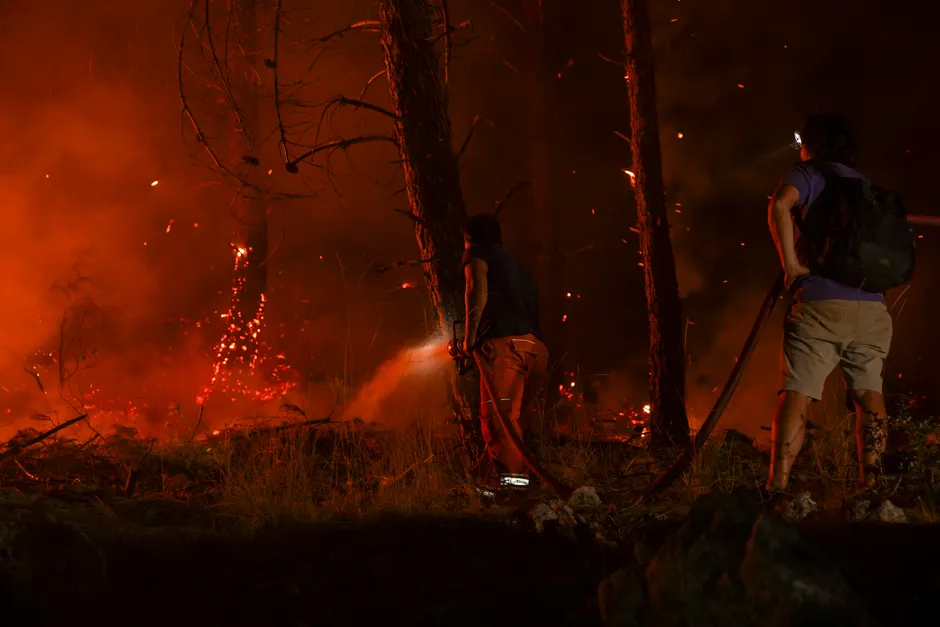
A forest fire that began near Saumos in the Gironde department on July 22, 2026 has burned 42,000 hectares of land — roughly four times the surface area of Paris — and forced the evacuation of 220,000 people across the region. By July 26, flames had reached the outskirts of Bordeaux, a city of 260,000 residents, placing extraordinary pressure on emergency services.
The first ignition actually started a day earlier, around 2 PM on July 21, near Bordeaux-Mérignac airport, according to the Gendarmerie nationale (France's national military police force). A second fire began the following day near Saumos, further west toward the Atlantic coast. That fire alone had covered more than 800 hectares by the evening of July 22 and reached 12,500 hectares by July 24. By July 26, the total burned surface across Gironde stood at 42,000 hectares.
Two firefighters (sapeurs-pompiers) died while responding to the fires, the Gendarmerie confirmed. The deaths occurred during an operation that, according to the prefecture's July 24 update, involved 260 ground vehicles and units (moyens terrestres) and 440 gendarmes deployed to manage evacuations and secure the fire's perimeter.
The evacuation zone expanded rapidly over a 72-hour window. On July 23, authorities activated FR-Alert — France's national population-warning system, similar to emergency phone broadcasts used in other countries — to order the immediate evacuation of villages on the Cap-Ferret peninsula. The prefecture (the central government's representative office in the department) then ordered preventive evacuations for several communes, including Le Porge, Saumos, Le Temple, and Lège-Cap-Ferret. Within 48 hours, 44,000 people had been displaced.
By July 25, the prefecture had triggered FR-Alert again for the communes of Saint-Aubin and Saint-Médard, and placed seven communes near Bordeaux under preventive evacuation orders. During the night of July 25 to 26, Marcheprime was evacuated. Eight communes bordering Bordeaux were evacuated as flames reached the city's edge. An additional 55,000 evacuations were ordered around July 25–26, bringing the cumulative total to 220,000 people displaced since July 22.
The crisis was not confined to Gironde. As of July 24, fires of exceptional intensity were also destroying forest in the neighboring department of Landes, according to the Gendarmerie nationale. By July 25, the combined evacuation figure for Gironde and Landes stood at 140,000 — a number subsequently overtaken by the July 26 Gironde-only total of 220,000.
The pace of escalation — from 800 hectares on the evening of July 22 to 42,000 hectares by July 26 — is striking on its own. But the geographic path of the evacuations tells the more consequential story. The fire advanced from rural forest communes toward the Bordeaux metropolitan area, forcing authorities to use FR-Alert for urban evacuations. The Cap-Ferret peninsula evacuation and the subsequent orders for Saint-Aubin, Saint-Médard, Marcheprime, and eight Bordeaux-bordering communes trace a fire front that progressively closed the distance to a major city.
The broader context here is what this crisis reveals about the limits of France's wildfire response framework. The deaths of two firefighters, the deployment of 260 ground resources alongside 440 gendarmes, and the repeated activation of FR-Alert across an expanding arc of communes each would individually constitute a major incident. Their convergence within a single 72-hour window defines this as what emergency planners call a compound crisis: multiple fire fronts, overlapping evacuation zones, and a resource pipeline stretched across two departments. The scenario — rural forest, coastal tourism communities, and a metropolitan periphery threatened at the same time — raises real questions about how response systems scale when fires move faster than the chain of command can adapt.
The early evacuations of the Porge Nord-Est neighborhood, involving roughly a hundred people on the first night, offer a sense of how granular the initial response was. These small, localized evacuations rapidly gave way to mass displacement as the fire front expanded. The transition from neighborhood-level orders to department-wide alerts occurred within roughly 48 hours.
What remains unclear from the available official communiqués is the containment status of the fire complex. The prefecture's situation updates have tracked hectares burned, people evacuated, and resources deployed, but a fixed perimeter or percentage of containment has not been reported in the verified communiqués. The ongoing issuance of FR-Alert notifications as late as July 25, with new communes added to evacuation orders, indicates that the fire front remained active and advancing four days after ignition.