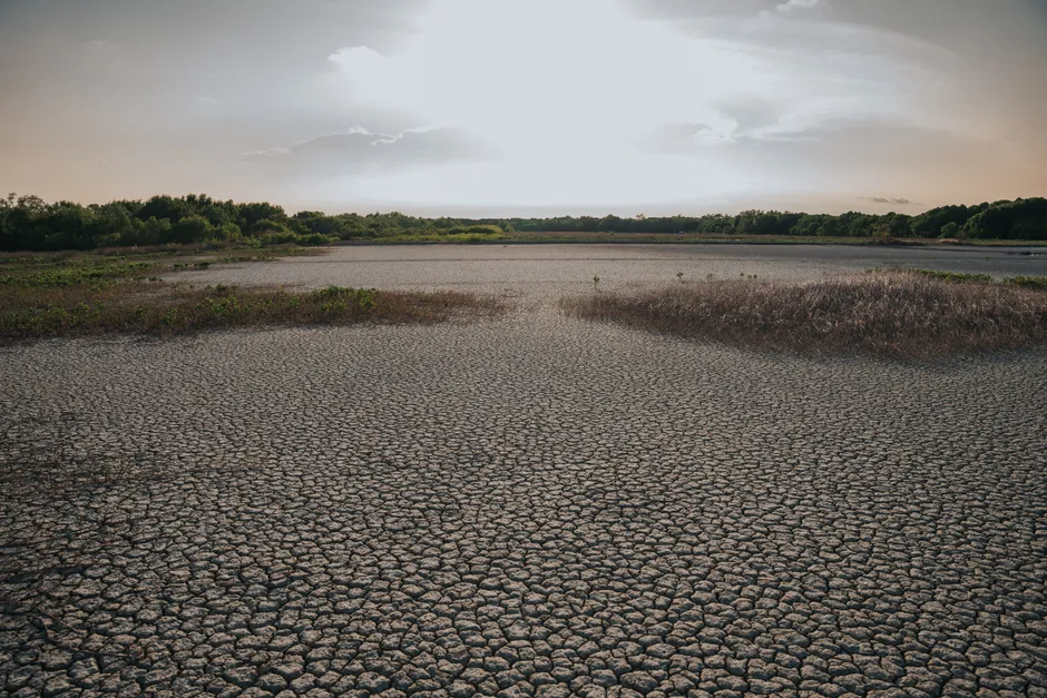
UK Heatwave: Met Office Forecasts 34°C Peak as UKHSA Issues Week-Long Health Alerts

The Met Office has forecast a week-long heatwave across parts of southern England and Wales, with temperatures peaking at 34°C in the south-east on 9 or 10 July 2026 — arriving less than a month after the UK provisionally broke its all-time June temperature record.
Temperatures in the south of England are expected to reach 28°C on 4 July, climbing to 29°C across the south-east on 5 July, then pushing into the low 30s through the following week before the 34°C peak, according to the Guardian's reporting of the Met Office forecast. Met Office meteorologist Becky Mitchell confirmed the event affects southern England and Wales, though no heat health warnings are in place for Wales as of 4 July.
The UK Health Security Agency responded by issuing yellow heat health alerts — the lower tier of the UKHSA–Met Office colour-coded alert system — across six English regions: London, the south-east, south-west, east, East Midlands, and West Midlands. The UKHSA dashboard places the London alert from 04:00 GMT on 4 July through midday on 11 July; the broader regional alerts run from midday on 4 July to 20:00 on 11 July. The North West has no active alert. At yellow level, the agency warns of minor but measurable impacts on health and social care services, with elevated healthcare utilisation among vulnerable groups and a raised mortality risk for that cohort.
The UKHSA also flagged a secondary risk that tends to get less official attention: water-related incidents. Hot weather drives people toward open water; cold water shock — the involuntary gasp and hyperventilation response to sudden immersion in cold water — significantly raises drowning risk regardless of swimming ability. The agency's warning on this point is consistent with its guidance published on 23 June, ahead of the current period of heat.
Water Supply and Infrastructure Pressure
Southern Water moved in parallel with the health agencies. The utility announced a hosepipe ban effective from 00:01 on 10 July 2026 in Hampshire and on the Isle of Wight — timed to coincide with the forecast temperature peak. Hosepipe bans are a demand-management instrument under the Water Industry Act 1991, restricting non-essential domestic use such as garden watering and vehicle washing. Southern Water's decision to act ahead of the peak, rather than reactively, reflects a shift in how UK water companies manage summer demand following the 2022 drought.
The Met Office has also noted that a long-lasting UK marine heatwave is likely to reach extreme levels in the coming week, a detail with implications beyond coastal leisure. Marine heatwaves suppress oxygen levels, stress fish stocks, and can accelerate harmful algal blooms along coastlines. For an island nation with active inshore fisheries and significant coastal tourism infrastructure, the compounding of an atmospheric and oceanic heat event is operationally significant.
Context: A Second Heatwave on the Heels of a Record-Breaking June
The backdrop is stark. In June, the UK recorded a provisional all-time June temperature of 37.7°C at Lingwood, Norfolk — shattering the previous June record of 35.6°C that had stood since 1976. During that event, the Met Office issued red warnings for extreme heat on three consecutive days, the first instance of consecutive red heat warnings since the extreme heat warning category was established in 2021.
The Met Office is explicit that the incoming July event will not match June's intensity or humidity. The distinction matters for public health modelling: prolonged moderate heat with overnight temperatures that remain elevated can accumulate physiological stress in vulnerable populations — particularly the elderly and those with cardiovascular or respiratory conditions — in ways that a shorter, sharper spike does not. A week at 30–34°C, with limited nocturnal cooling, can drive excess mortality even when the headline peak looks less alarming than a 37°C day.
The frequency of back-to-back heatwave episodes in the UK is consistent with projections from the Met Office's UK Climate Projections. Under current trajectories, events that were once statistically extreme are occurring with regularity that strains both infrastructure designed for temperate baselines and public health systems calibrated to respond to episodic rather than sustained heat stress. The yellow alert tier persisting for seven consecutive days — rather than covering a discrete 48-hour window — is itself a signal of how the operational framing of heat risk in the UK has changed.
For those monitoring health system demand, water network strain, or agricultural exposure, the combination of a sustained atmospheric heatwave and a concurrent marine heatwave reaching extreme classification in the same week is the operative planning variable, not any single temperature reading.