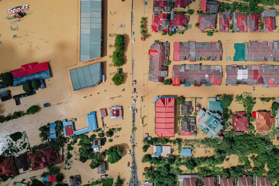
Typhoon Dujuan Hits Eastern Japan, Forcing Nearly Two Million to Evacuate

Typhoon Dujuan tracked along Japan's eastern Pacific coast on Monday, September 21, 2026, bringing heavy rain, powerful winds and widespread disruption. The large typhoon moved toward the Pacific coast of eastern Japan, prompting flood and landslide warnings across eastern Japan. BBC Reuters
Satellite footage showed Dujuan crossing the Pacific toward Japan as it closed on the coast. The Japan Meteorological Agency, the national weather service, issued Tropical Cyclone Information on September 21. It reported maximum winds near the center, the strongest part of the storm, of 40 meters per second and warned that strong winds and high waves may be observed. BBC Japan Meteorological Agency
Police urged nearly two million people at risk in Tokyo and surrounding areas to leave their homes. The evacuation call covered a wide portion of the capital region. Heavy rain from the typhoon triggered landslides, when saturated soil slips down a slope, in Chiba and Kanagawa. BBC Kyodo News
The broader context here is coordination under uncertainty. An advisory for nearly two million residents is like trying to run messaging, shelters and transport for a large city all at once. Compliance varies. Some leave early. Others wait for local cues such as river levels, slope failures or suspension of rail services. For local authorities, the priority is to move people before access routes degrade.
Looking at what this means for the next hours, rainfall intensity, wind structure and coastal exposure will shape events. Landslides already reported in Chiba and Kanagawa point to saturated ground east and south of Tokyo. Flood and landslide warnings keep focus on river basins, steep slopes and low-lying districts. Strong winds and high waves along the Pacific shoreline also complicate ports, coastal roads and emergency movement.
In my view, the picture will sharpen only with damage verification. Warnings outline hazard. Evacuation figures outline exposure. What remains to be documented is impact across housing, infrastructure, power and transport, and any casualties. Until those details emerge, the evacuation call and the confirmed landslides are the firmest markers of severity.