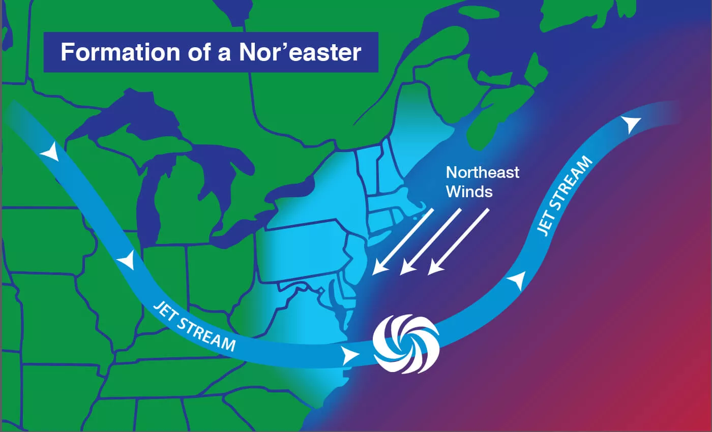
First Fall Nor'easter Batters New England as Pacific Hurricanes Churn

A first fall nor'easter was battering New England on September 25, 2026, with forecasters warning up to 40 million people across multiple states could be affected. The Guardian
By Friday morning, September 25, 2026, the system was already lashing coastal areas of Rhode Island, Massachusetts, Connecticut and New York's Long Island. High wind warnings were in place in Boston and neighboring areas that morning. The Guardian
The National Weather Service's Boston office forecast strong winds, rough seas and a prolonged period of steady rain through the weekend, with rain possibly lasting until Monday. Its main concerns were beach erosion, coastal flooding, and wind damage including downed limbs and power outages. The threat is water and wind.
AccuWeather forecast 40-60 mph winds along the coast from New Jersey to Maine beginning late September 25, with up to 80 mph in and around Montauk, New York. Pressure changes sharpen near the coast, raising winds. Exposure will be highest on open headlands and barrier shorelines. The Guardian
Rainfall totals were forecast to vary sharply by location. Up to 8 inches of rain was forecast for parts of southeastern Massachusetts. Up to 2 inches was forecast in Boston for Friday into Saturday, September 25-26, 2026, and the same amount in New York City a day later.
The East Coast system was not the only active tropical and extratropical threat. Three Pacific hurricanes named Nolo, Odalys and Polo were active on September 25, 2026. Hurricane Nolo was expected to be a major Category 3 storm as it passed about 80 miles south of Hawaii's Big Island early on Saturday, September 26, 2026. It was not forecast to make landfall in Hawaii but was expected to bring five days of torrential rain through Monday with catastrophic flooding and mudslides. The Guardian
Hurricane Polo remained offshore of Mexico on September 25, 2026, about 250 miles south-southwest of the Jalisco coast, with 160 mph winds after rapidly intensifying from a tropical storm to Category 5 earlier that week.
National Weather Service forecast discussions framed the nor'easter as a prolonged coastal event rather than a brief passage. The Boston Area Forecast Discussion stated the strong nor'easter would bring prolonged rain, rough seas, strong winds, and coastal flooding and beach erosion starting September 25. The New York office pointed to significant coastal impacts to the Mid-Atlantic and New England through the weekend, with moderate to major coastal flooding, heavy rain and high surf. Farther inland, the Central Pennsylvania office expected the system to stay far enough offshore on Saturday and Sunday, with mainly light rain only for the eastern half of its forecast area.
For Hawaii, the National Hurricane Center reported at 11:00 PM HST on September 24, 2026 that Nolo was strengthening while moving north-northeastward near 15.5N 155.6W, with catastrophic and life-threatening flash flooding possible on the Big Island into the weekend. Local Statement Advisory Number 16 warned excessive rainfall could lead to locally catastrophic flash flooding and mudslides mainly on the windward and southeast portions of the Big Island. In Boston, the point forecast for 42.36N 71.07W called for rain likely mainly after 5am with a 90% chance of precipitation, and breezy northeast winds around 23 mph with gusts as high as 45 mph overnight.
The broader context here is concurrency and duration. Multi-day rain, steady onshore winds and high surf strain sea walls, power lines and drains together. Parallel Pacific hurricanes stretch forecast resources and complicate warnings, even without landfall.