Twin Earthquakes Strike Peru's Junín Region: Six Dead, Emergency Declared
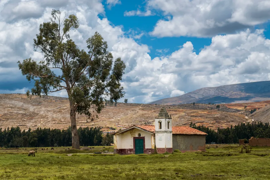
Two earthquakes struck Peru's Junín region on the night of July 18, 2026, killing at least six people and prompting the Peruvian government to declare a state of emergency the following day. The first quake, measuring magnitude 5.1, was recorded at 21:24 local time at a depth of 24 km. A second tremor of magnitude 3.7 followed at 21:41 at a depth of 18 km, according to Peru's National Seismological Center (Al Jazeera; INDECI). The epicenter was in the district of Chongos Bajo, Chupaca province, at latitude -12.12 (INDECI).
The death toll shifted across reporting cycles as information came in. Initial accounts from Exitosa radio cited five deaths. Reuters, citing Peru's civil defense chief, reported six. Peru's Premier confirmed six fatalities on July 19 (TV Peru), making that the authoritative figure. Injury counts also moved: early reports put the number at 21, while INDECI's preliminary report listed 32 people treated, and TV Peru reported approximately 40 injured with 300 affected (damnificados) (TV Peru; INDECI). These discrepancies are common in the first 24 hours of a disaster, when damage assessments are still unfolding and access to affected areas may be limited.
Luis Vasquez, head of Peru's National Civil Defense Institute (INDECI), reported at least 48 homes destroyed, 18 damaged, and roughly 300 people displaced (Al Jazeera). The structural toll is closely tied to how homes are built in the affected zone. Chupaca, about 300 km east of Lima, has many houses constructed with adobe — sun-dried mud bricks — a material highly vulnerable to seismic shaking. On the Modified Mercalli Intensity (IMM) scale, which measures how strongly shaking is felt at the surface rather than the total energy released, the magnitude 5.1 event reached level IV-V in Chupaca, while the magnitude 3.7 aftershock registered level III, according to INDECI's seismic bulletins (INDECI; INDECI). IMM level IV-V corresponds to light to moderate perceived shaking with potential for minor structural damage in vulnerable building types. Combined with adobe construction, the risk of collapse increases substantially even at these intensities.
There is a discrepancy in magnitude measurement between seismological agencies. Peru's National Seismological Center recorded the primary quake at magnitude 5.1. The European-Mediterranean Seismological Centre (EMSC) estimated it higher, at magnitude 5.6 (Al Jazeera). Differences of this kind are routine. They typically arise from distinct velocity models (the assumptions about how seismic waves travel through different rock layers), station distribution (where sensors are placed relative to the quake), and processing algorithms used by each network.
President-elect Keiko Fujimori issued a statement of condolence following the quakes (Al Jazeera). Peru's Premier, acting on behalf of the incoming administration, confirmed six fatalities and announced three measures: a state of emergency for the affected zone, financial bonds for victims, and continued damage assessment (TV Peru). In Peru's disaster response framework, a state of emergency typically accelerates the allocation of federal resources, suspends certain procurement procedures, and grants authorities expedited powers to coordinate relief.
INDECI's institutional response was rapid. The agency issued a preliminary report (No. 0678) on the night of July 18 and followed with multiple complementary reports on July 19, including Nos. 9423, 9424, and 9425, each refining casualty figures, damage tallies, and seismic parameters (INDECI; INDECI). The National Seismic Information Bulletins (Nos. 468-2026 and 469-2026) provided the precise timestamps and intensity data for each event.
The broader context here matters for understanding why a magnitude 5.1 event, which would be modest in many seismically active regions, produced disproportionate human impact. The convergence of shallow focal depth (24 km and 18 km), adobe construction prevalent in Chupaca's housing stock, and the relatively rural nature of the affected district compounded vulnerability. Peru sits along the South American subduction zone, where the Nazca Plate descends beneath the South American Plate. Think of it as one tectonic plate sliding underneath another, gradually building pressure until it releases as an earthquake. This makes Peru one of the world's most seismically active countries. But it is not the tectonic setting alone that determines outcomes. Building typology and enforcement of seismic codes in rural districts like Chongos Bajo are the variables that convert a moderate event into a lethal one.
For the Fujimori administration, which had not yet assumed office at the time of the quake, the crisis presents an early governance test. The Premier's announcement of emergency bonds and a state of emergency signals an intent to move quickly, but the gap between announcement and disbursement, the adequacy of bond amounts, and the speed of adobe-to-resilient housing replacement in Chupaca will be the metrics by which the response is judged in the coming weeks.


