Confirmed Tornado Tears Through Wisconsin's Fox Cities, Leaving 30,000 Without Power
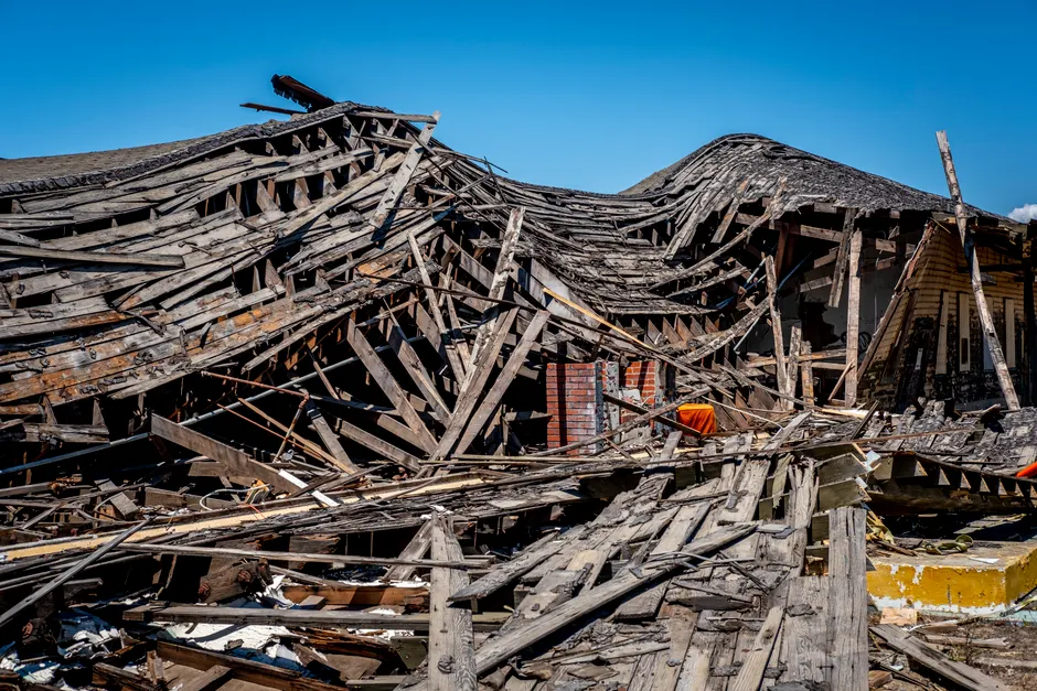
A confirmed tornado struck northeastern Wisconsin's Winnebago County on Monday, July 27, 2026, cutting a path of destruction through the Fox Cities region. The storm ripped roofs from homes, flipped vehicles, and knocked out power to more than 30,000 people. The National Weather Service confirmed the tornado formed over Appleton around noon, with damage reported across Appleton, Menasha, and the east side of Fox Crossing (The Guardian; Milwaukee Journal Sentinel).
The storm first hit at approximately 12:20 p.m., according to Menasha Police Chief Matt Albrecht. Just over twenty minutes earlier, at 11:59 a.m., NWS meteorologists in Green Bay had issued a tornado warning for the Fox Cities region, covering Appleton, Menasha, and Neenah. The area had already been under a severe thunderstorm warning for about 45 minutes before the tornado warning went out. A severe thunderstorm warning means conditions are capable of producing damaging winds or large hail; a tornado warning is a higher-level alert meaning a tornado has been spotted or detected by radar. The thunderstorm had been producing winds up to 97 km/h. The tornado warning expired at 12:45 p.m. By 12:25 p.m., the tornado was over Lake Winnebago and moving southward toward Fond du Lac County (The Guardian; Milwaukee Journal Sentinel).
Menasha, a city of about 18,000 residents just blocks from the shores of Lake Winnebago and roughly 30 miles south of Green Bay's Lambeau Field, took some of the heaviest damage. Roofs were torn off homes. Vehicles were flipped. Some houses were reduced to their outer walls. CNN-obtained video showed structures in Menasha stripped of their exteriors. The entire city was believed to be without power in the storm's immediate aftermath (The Guardian; CNN).
Chief Albrecht said many roads in affected areas were impassable and urged residents to shelter in place. Downed power lines, downed trees, and multiple hazardous situations were reported across the impacted zones. Authorities opened a shelter at a church in Menasha for displaced residents (The Guardian).
Winnebago County's top elected official, Gordon Hintz, reported multiple buildings completely destroyed and vehicles overturned. Hintz said he was not aware of any fatalities or injuries as of the time of reporting, though emergency officials were still conducting searches. NWS meteorologist Holley Kamba, speaking from the Green Bay office, corroborated that no injuries had been reported so far. Kamba said damage reports were received from southern Outagamie County and eastern Winnebago County (The Guardian).
Wisconsin Governor Tony Evers said the state is ready to assist affected communities. All available storm warnings were activated ahead of the tornado to get people to safety. The NWS forecast severe weather continuing through Monday afternoon across east central and southeastern Wisconsin, with strong winds, hail, and the possibility of isolated brief tornadoes (The Guardian).
The NWS Green Bay forecast office published a preliminary severe storm summary on its website, updated as of 4 p.m. on July 27. Separately, the NWS Green Bay blog documented the day's tornado events as part of its 2026 tornado log. An organized line of storms had also produced two tornadoes over western Shawano County, with wind gusts of 60 to 90 mph. A Severe Thunderstorm Watch (Watch 519) had been issued for northeastern Wisconsin covering Dundas, Manitowoc, and Menasha. A watch means conditions are favorable for severe weather over a broader area, whereas a warning means severe weather is occurring or imminent. The NWS Milwaukee/Sullivan office also issued a tornado warning for eastern Fond du Lac County as the system tracked southward (The Guardian; NWS Green Bay; NWS Green Bay Blog; NWS Green Bay Emergency Management; NWS WWA Map).
The Associated Press, reporting by Scott Bauer and Cybele Mayes-Osterman with photographs by Douglas Tom Williams, syndicated coverage to multiple regional outlets including KGW in Portland, PinalCentral in Arizona, The Morning Call in Allentown, and Newsday on Long Island. The breadth of syndication reflected the severity of the event relative to typical summer severe weather in the Upper Midwest (KGW; PinalCentral; The Morning Call; Newsday; Telegraph Herald).
The broader context here involves the sequence of warnings and the tornado's track through a densely populated corridor of the Fox Valley. The 45-minute severe thunderstorm warning preceding the tornado warning provided a window for situational awareness, but the transition from a severe thunderstorm warning to a tornado warning compresses the decision cycle for residents. People have minutes, not hours, to decide whether to seek shelter. The absence of reported fatalities or injuries, if it holds as searches conclude, would suggest that the warning chain functioned as designed. Still, the extent of structural damage across Menasha indicates the tornado's intensity was substantial regardless of classification. The NWS will conduct post-event damage surveys to assign an EF-scale rating, the Enhanced Fujita scale, which rates tornado intensity from EF0 to EF5 based on wind speed and damage. That survey will clarify whether this was a single continuous tornado or a multi-vortex system producing segmented damage paths across Winnebago and Fond du Lac counties.