A Rebuilt Mall Collapses Again: The Kumamoto Earthquake and What It Tells Us About Seismic Risk
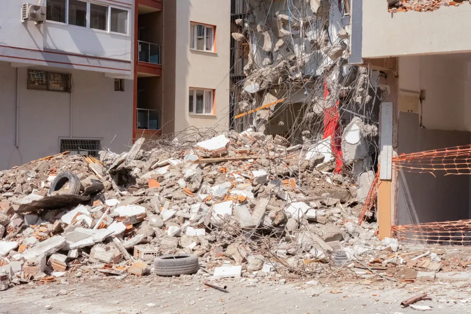
A magnitude 7.1 earthquake struck the Kumamoto region on Japan's southern island of Kyushu on July 28, 2026, collapsing the second floor of an Aeon Mall shopping center in Kashima Town and leaving at least 50 people injured, according to Reuters. The Japan Meteorological Agency (JMA) recorded the mainshock and issued a tsunami warning, which was lifted within two hours. The USGS independently assessed the event at magnitude 6.8, locating the epicenter 5 km east of Uto and classifying the mechanism as a shallow strike-slip event (USGS).
A strike-slip earthquake means the ground on one side of a fault slides horizontally past the other side, rather than one block pushing over or under the other. Think of it like two hands rubbing past each other in opposite directions. Shallow events, typically less than 15 km deep, tend to produce more intense shaking at the surface because the released energy has less distance to dissipate.
The human toll is concentrated at the Aeon Mall in Kashima Town, Kumamoto Prefecture. The second floor of the shopping center collapsed during the quake. NPR reported that between 20 and 30 employees were inside at the time (NPR). The local fire department stated that many people were trapped inside the collapsed structure, according to The Guardian and France 24. NHK reported that police said about 20 to 30 people are unaccounted for (NHK. Reuters separately reported that workers were missing after the earthquake.
The Aeon Mall had just reopened after being rebuilt from the 2016 Kumamoto earthquake, according to Reuters. The 2016 sequence, which included a magnitude 7.0 mainshock, caused extensive damage across Kumamoto Prefecture and resulted in 50 deaths.
Beyond the mall collapse, infrastructure damage is widespread. A footbridge collapsed in the Kumamoto region, and roads have sustained damage, according to BBC News. Kyushu Electric reported more than 40,000 households without power via its website. JMA has recorded more than 60 aftershocks ranging from magnitude 1 to 4. JMA's earthquake listing shows a continuous cluster of seismic events in Kumamoto Prefecture spanning at least from 13:08 JST to 15:36 JST on July 28, distributed across two distinct JMA-designated regions: "Kumamoto Region, Kumamoto Prefecture" and "Amakusa and Ashikita Region, Kumamoto Prefecture" (JMA). The sequence included at least two events reaching seismic intensity 4 on the JMA scale: a magnitude 4.8 at 14:02 JST and a magnitude 4.1 at 15:15 JST.
Japan uses its own seismic intensity scale, which measures how strongly shaking is felt at a given location, rather than the total energy released. Intensity 4 means most people are startled and hanging objects swing significantly, and unstable furniture may move. This is different from magnitude, which describes the earthquake's overall size.
Shaking was felt across a broad swath of Kumamoto Prefecture. JMA's seismic intensity observation points for the event include Amakusa City, Ashikita Town, Tsunagi Town, Hitoyoshi City, and Nishiki Town (JMA). WGN-TV reported that shaking was felt in the Amakusa and Ashikita regions (WGN-TV.
The magnitude discrepancy between JMA (7.1) and USGS (6.8) is not unusual. The two agencies use different seismic networks, velocity models, and magnitude scales. JMA's magnitude calculations incorporate regional attenuation relationships calibrated for the Japanese archipelago, while USGS typically reports moment magnitude (Mw) derived from teleseismic waveform inversion. For shallow crustal events in Japan, differences of 0.2 to 0.4 magnitude units between the two agencies are common and do not necessarily indicate a measurement error.
In plain terms, JMA tunes its calculations specifically for Japan's geology, while USGS applies a global standard. Both are valid approaches, and the small gap between their numbers reflects different methods rather than a mistake.
The shallow strike-slip classification from USGS is geologically consistent with the active fault systems in central Kyushu. The 2016 Kumamoto sequence ruptured the Futagawa-Hinagu fault zone, a right-lateral strike-slip system. Whether the July 28, 2026 event occurred on the same fault segment or an adjacent structure will require focal mechanism analysis and, if available, finite fault inversion results. The spatial proximity to Uto, which sits near the western terminus of the Futagawa fault, suggests potential reactivation or triggered slip on related structures.
Prime Minister Fumio Kishida's office responded with public commentary. AP News published video of the Japanese PM commenting after the earthquake struck Kyushu (AP News). The Tuesday timing of the event meant the mall and surrounding commercial infrastructure were operating on a normal weekday schedule when the quake hit at early afternoon local time.
The broader context here is one of compounding seismic risk in Kumamoto Prefecture. A structure rebuilt after the 2016 sequence, presumably under post-disaster building code revisions, has failed again under a comparable-magnitude event. The number of people unaccounted for, the scale of infrastructure damage, and the ongoing aftershock sequence all point to a protracted emergency response and recovery phase. The gap between JMA and USGS magnitude estimates, while routine, will matter for post-event structural assessments: building performance is typically evaluated against recorded peak ground acceleration and seismic intensity, not headline magnitude. Engineers and emergency managers on the ground will be working from JMA intensity data, which showed maximum seismic intensity 4 at multiple observation points, a level that can cause significant damage to vulnerable structures but is below the intensity 6 upper that devastated Kumamoto in 2016. The mall collapse at intensity 4 levels warrants scrutiny of whether site-specific amplification, structural deficiency, or cumulative damage from the 2016 sequence played a role.
The destruction of a structure specifically rebuilt to withstand future seismic events raises immediate questions about building code adequacy, retrofit standards, or the possibility that strike-slip faulting near Uto produced ground motion exceeding design assumptions. In my view, the most important question is not the magnitude debate but whether this collapse reflects a broader gap between engineering assumptions and what these faults can actually deliver.


