8.2-Magnitude Earthquake Off Mindanao Triggers Tsunami Warnings Across the Pacific Rim

A Major Seismic Event in the Southern Philippines
A powerful earthquake measuring magnitude 8.2 struck off the Mindanao region of the southern Philippines on June 8, 2026, prompting immediate tsunami warnings across multiple countries, including the Philippines, Indonesia, and Japan, according to Al Jazeera. The event places the southern Philippines — a seismically active zone sitting astride the Philippine Trench and the Cotabato Basin fault system — at the center of a coordinated regional emergency response.
An 8.2 Mw event is a low-frequency, high-consequence rupture. To calibrate: the moment magnitude scale is logarithmic, meaning an 8.2 releases roughly 2.8 times the energy of an 8.0. Events of this magnitude are capable of generating tsunamis with open-ocean wave heights measured in meters and runup heights — the actual inundation elevation at shore — that can exceed ten meters in near-field coastal zones. The Philippine authorities were correct to issue warnings without waiting for wave confirmation; post-2004 Indian Ocean doctrine mandates warnings on seismic thresholds alone when the geometry and depth are consistent with tsunamigenic rupture.
Regional Exposure: Indonesia and Japan
The cascading issuance of tsunami warnings in Indonesia and Japan reflects both the mechanics of trans-oceanic wave propagation and the institutional architecture built after decades of painful lessons. The Philippine Sea connects directly to the broader western Pacific basin, and a shallow thrust rupture on the scale recorded June 8 can propagate hazardous waves across thousands of kilometers within two to three hours.
Indonesia's exposure is twofold: its northern and eastern archipelago — the Maluku and Papua provinces in particular — faces the Philippine Sea directly, while its warning infrastructure has been substantially upgraded since the 2004 Sumatra-Andaman earthquake and tsunami. Japan's participation in the warning chain is institutional as much as physical. Tokyo operates one of the world's most sophisticated early-warning networks and, given the geometry of the Pacific Rim, cannot exclude trans-Pacific or inter-basin wave arrivals when a high-magnitude event occurs anywhere along the western Pacific subduction corridor.
Japan experiences approximately 1,500 earthquakes per year, accounting for roughly 18% of global seismic activity. That density of events has produced both a culture of preparedness and a bureaucratic reflex for rapid, graduated warnings — protocols that now benefit neighboring states through shared data and real-time telemetry.
The Philippines' Seismic Context
The June 8 event does not occur in isolation. A magnitude 6.0 earthquake struck the central Philippine island of Samar on May 4, 2026, at 2:09 PM local time (0609 GMT) at a focal depth of 73.3 kilometers, per the U.S. Geological Survey. A month earlier, on April 20, 2026, a magnitude 7.4 event struck off the east coast of Honshu, Japan, itself generating a tsunami warning from Tokyo.
Neither precedes the Mindanao event in any established predictive sense — seismology does not support reading regional foreshock sequences at this scale with confidence — but the pattern across the first half of 2026 underscores a period of elevated seismic activity along the western Pacific subduction zones. Whether that clustering is statistically anomalous or within long-term variance remains a question for catalog analysis, not headlines.
The Philippines sits on the Philippine Mobile Belt, a tectonically complex domain where the Philippine Sea Plate subducts beneath the Eurasian Plate to the west and overrides the Sunda Plate in places. Mindanao, the country's second-largest island, is particularly exposed: the Mindanao Trench reaches depths exceeding 10,000 meters off its eastern coast, and the convergence rate between the Philippine Sea Plate and the Philippine archipelago is among the highest on Earth — roughly 80–100 millimeters per year. That kinetic energy budget has to resolve somewhere, and it resolves as earthquakes.
Warning Architecture and the Race Against Wave Arrival
We have seen this pattern before — the cascade from seismic detection to warning issuance to evacuation orders — accelerate and sometimes fail in ways that defined modern tsunami policy. The 2011 Tōhoku earthquake and tsunami killed nearly 20,000 people despite Japan's state-of-the-art warning system, not because the warnings failed to issue but because wave heights dramatically exceeded modeled forecasts and evacuation compliance was incomplete in some communities. That event reset international benchmarks for both forecast modeling and the critical "last mile" of public communication.
For the Philippines, June 8 activates a warning architecture that has been progressively strengthened through ASEAN regional cooperation and bilateral agreements with the Japan Meteorological Agency and the Pacific Tsunami Warning Center (PTWC) in Hawaii. The PTWC serves as the authoritative source for open-ocean threat assessments in the Pacific basin, issuing bulletins to member states that feed national-level decision-making. The speed of the multi-country warning cascade on June 8 is a product of that architecture functioning as designed.
Operational Priorities in the Immediate Window
In the hours following a major tsunamigenic earthquake, the operational sequence is well-defined: coastal evacuation of low-lying zones, port closures, suspension of maritime traffic, and staged monitoring of tide gauge and DART buoy data to refine wave height estimates and narrow the threat window. The DART — Deep-ocean Assessment and Reporting of Tsunamis — buoy network across the Pacific provides real-time bottom-pressure data that allows forecasters to distinguish a destructive tsunami from a sub-hazard perturbation within the first wave cycle.
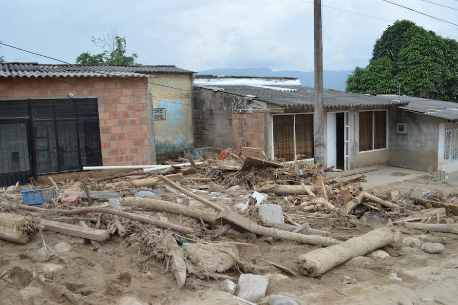
For Mindanao specifically, near-field warning time is measured in minutes rather than hours. Communities within 50–100 kilometers of the epicenter cannot rely on formal warning receipt before wave arrival; vertical evacuation — moving to upper floors of engineered structures or elevated terrain — is the only viable response in that time window. Whether local preparedness, land-use planning, and public education are adequate to that task is a standing question in a country where coastal poverty and informal settlement patterns persistently concentrate vulnerability precisely where it is most dangerous.
What Comes Next
The immediate priority is life safety and damage assessment. Once the wave threat window closes — typically evaluated when at least two full wave cycles have been observed without destructive runup — authorities shift to search-and-rescue operations in any affected coastal areas and structural assessment of buildings in the epicentral zone, where strong ground shaking will have caused damage independent of any tsunami.
Aftershock sequencing following an 8.2 Mw event is a further operational concern. Statistical models predict significant aftershocks — potentially in the M6–7 range — within hours to days, which complicates search-and-rescue operations in damaged structures and can trigger additional localized tsunamis if aftershock geometry is favorable.
The broader institutional question — how well the multi-nation warning chain performed end-to-end, from seismic detection through public alert to evacuation compliance — will be the subject of post-event review by national agencies and the PTWC. Those reviews, more than the event itself, are where the lessons that protect the next generation of coastal residents are written.