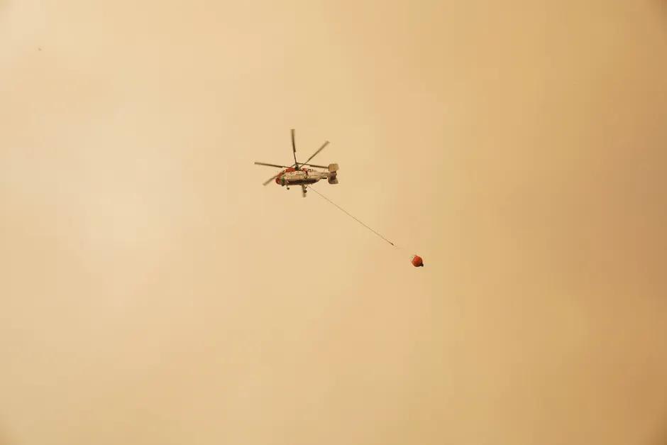
Over 800 Wildfires Rage Across Canada as Hazardous Smoke Engulfs Great Lakes and Northeastern US

More than 800 active wildfires were burning across Canada as of July 14, 2026, with the Canadian Wildland Fire Information System reporting that the vast majority were burning out of control BBC News. A large cluster of fires in western Ontario has sent thick plumes of smoke across Thunder Bay and Toronto, degrading air quality across both cities. IQAir ranked Detroit as having the worst air quality in the world, followed by Minneapolis and Toronto BBC News.
The smoke's reach extends far beyond the immediate fire zones. Lower concentrations of particulate matter high in the atmosphere have been drifting over the Great Lakes and above New York, producing hazy skies and redder sunrises and sunsets. Northwesterly winds are expected to continue pushing smoke into northern US states through the weekend. AirNow.gov's Minnesota state page reported a PM2.5 AQI of 275, categorized as "Hazardous," with the Mississippi River Valley area registering a "Very Unhealthy" PM2.5 AQI of 151 AirNow.gov. AirNow.gov's National Maps page, updated July 15 at 11:00 PM PDT, listed "Hazardous" as the highest current AQI category nationwide AirNow.gov.
Statewide air quality alerts were issued in Michigan on July 14 due to combined smoke from Canadian and Minnesota wildfires Detroit Free Press. Wisconsin also issued air quality advisories in response to the Canadian smoke. The National Weather Service office in Buffalo posted that smoke from wildfires in northern Minnesota and Canada would continue causing poor air quality across its forecast area NWS Buffalo.
In Minnesota, the governor mobilized the National Guard on July 13 to battle wildfires in the northern part of the state, where blazes had consumed more than 800 acres over five days and remained uncontained, according to a state website cited by Reuters. Reuters also reported on July 14 that wildfires were simultaneously raging across both Europe and North America, underscoring the transcontinental scale of this fire season Reuters.
Forecasting tools are being heavily relied upon. FireSmoke.ca's BlueSky Canada smoke model provides high-resolution, interactive forecasts of hourly, daily average, and daily maximum PM2.5 concentrations at ground level, offering a two-day best estimate of smoke event timing and geography FireSmoke.ca. The Canadian Interagency Forest Fire Centre (CIFFC) produces a daily situation report delivering intelligence on the fire situation to all stakeholders, with its Canada Report last updated on July 8 and nine files available CIFFC.
Widespread thunderstorms are forecast across Ontario in the coming days, but the rainfall is not expected to meaningfully alter fire behavior. A wind direction shift by Monday is projected to redirect the smoke plume across Quebec, which should bring some air quality improvement to southern portions of the United States. The timing is consequential: there are concerns that smoke could drift into New Jersey, where the World Cup final is scheduled for Sunday BBC News.
The broader context here is one of compounding cross-border environmental stress. The 2023 Canadian wildfire season established a template for how smoke transport can degrade air quality thousands of kilometers from the ignition source, and the current event is following a similar atmospheric pathway. What distinguishes this episode is the convergence of Canadian and Minnesotan fire activity simultaneously driving AQI into the "Hazardous" tier across multiple US population centers, with Detroit, Minneapolis, and Toronto occupying the three worst global rankings on IQAir. That a single smoke event can simultaneously place three major cities at the top of a global air quality index tells you something about the scale of biomass combustion underway.
For stakeholders in emergency management, public health, and aviation, the operational picture is fluid. CIFFC's daily situation reports and BlueSky's two-day PM2.5 forecasts are the primary forward-looking tools, but both depend on meteorological variables that remain in flux. The expected wind shift by Monday offers a plausible endpoint for the worst of the southern Canadian and northern US exposure, but that same shift redirects the problem eastward into Quebec. The World Cup final in New Jersey adds a high-visibility inflection point: if smoke concentrations elevate there on Sunday, the event could serve as a real-time demonstration of how transboundary wildfire pollution intersects with large-scale public gatherings.
What remains uncertain is whether the forecast Ontario thunderstorms will deliver enough precipitation to reduce fire intensity at the source, or whether the current fire complex will continue expanding under prevailing dry and windy conditions. The most recent CIFFC Canada Report is now eight days old, and a refreshed assessment would clarify whether the 800-fire figure has grown.