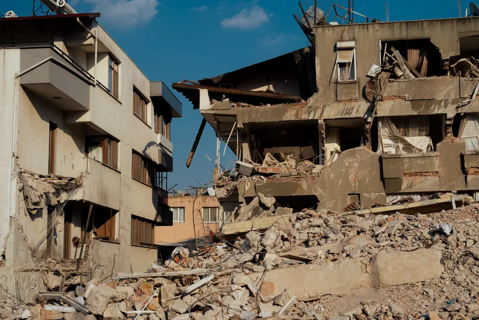
Magnitude 7.4 Earthquake Strikes Western Colombia: What the Science Tells Us

A magnitude 7.4 earthquake struck 5 km east of San José del Palmar, Colombia, on August 10, 2026, at 12:34:27 UTC, according to the U.S. Geological Survey. The quake was centered at coordinates 4.903°N, 76.189°W with a depth of 107.0 km. USGS assigned the event identifier us6000tjl2 and gave it a REVIEWED status, meaning the solution has passed analyst-level quality control beyond initial automated processing.
The epicenter sits in the western Colombian Andes, within the department of Chocó, a sparsely populated but tectonically complex region. Here, the oceanic Nazca Plate is being forced beneath the continental South American Plate in a process called subduction. San José del Palmar lies in a mountainous zone where two major mountain chains, the Western and Central Cordilleras, converge. The depth of 107 km places the rupture well below the shallow boundary where the two plates meet, classifying it as an intraslab event, meaning the earthquake occurred within the descending plate itself rather than at the interface where plates grind against each other.
This distinction matters. Intermediate-depth earthquakes of this magnitude tend to lose energy more quickly as seismic waves travel outward compared to shallow quakes of similar size. Think of it like a sound muffled by layers of insulation: the deeper the source, the more material the waves pass through before reaching the surface. Peak ground shaking near the epicenter may be less extreme than a shallow M 7.4 would produce, but felt reports can extend across a very broad radius.
The mww, or moment magnitude W-phase, solution is USGS's preferred rapid magnitude for events of this size. It is derived by analyzing long-period seismic waves known as W-phases, which travel through Earth's interior and allow for quick, reliable magnitude estimates even before all data are in. The REVIEWED status gives the published parameters a higher confidence level than a contributor-reported or auto-located event.
Colombia sits along the northern segment of the South American subduction margin, where the Nazca Plate descends beneath the South American Plate at roughly 6–7 cm per year. This subduction zone has produced numerous large earthquakes historically, including several destructive events along the Pacific coast. The specific tectonic environment near 4.9°N, 76.2°W lies close to the intersection of the subduction interface with the complex faulting of the Panama block and the North Andean block. Whether this event ruptured within the downgoing slab or along a secondary fault associated with that triple-junction geometry will be clarified as more detailed analyses and aftershock patterns become available.
The broader context here is that intermediate-depth earthquakes of this magnitude, while less destructive at the surface than shallow thrust events of similar size, still carry significant hazard potential for vulnerable infrastructure. A depth of 107 km reduces surface ground motion relative to a shallow rupture, but an M 7.4 releases roughly the energy equivalent of 1,400 Hiroshima-scale devices. For communities in the Chocó region and nearby population centers in the Cauca and Valle del Cauca departments, even weakened shaking from an event this size can trigger landslides in steep, saturated terrain and stress aging or non-engineered structures. The 107 km depth also means the fault area is large, and aftershocks may be distributed across a broad three-dimensional volume, complicating rapid damage assessment.
The region around San José del Palmar is characterized by rugged topography and limited road infrastructure, factors that historically have impeded rapid post-event response. The intermediate depth may reduce the likelihood of widespread catastrophic building collapse, but secondary hazards such as landslides, liquefaction (where water-saturated soil behaves like a liquid) in alluvial valleys, and disruption to hydroelectric infrastructure along the Cauca River system remain plausible concerns. The Colombian Geological Service (SGC) operates a national seismological network and will produce its own independent fault-plane solution and intensity maps, which will be critical for refining the hazard picture beyond USGS's preliminary parameters.
One aspect worth monitoring is whether this event has any bearing on stress transfer along the shallow megathrust. Large intermediate-depth ruptures can theoretically alter the stress state on adjacent fault segments, though the magnitude of such effects depends on the specific geometry of the slab and the receiving faults. At 107 km depth, the direct connection to the shallow seismogenic interface (typically 10–40 km in this region) is likely modest, but the event serves as a reminder that the Nazca-South America convergence remains highly active across the full depth range of the subduction system.