Heavy Rain Forecast for the UK Won't End the Drought — Here's Why

The Met Office forecast heavy rain across much of the UK for the week beginning 18 August 2026, but the agency and hydrology experts agree the downpours will not reverse widespread drought conditions now affecting more than 71% of England. The forecast arrives as South East Water told customers in Kent to use water only for essential purposes after taps ran dry for roughly 8,000 customers on Monday, and Wessex Water imposed a hosepipe ban covering 1.4 million customers across Bath, Somerset, Dorset and Wiltshire — its first such ban in 50 years, since the summer of 1976. (The Guardian)
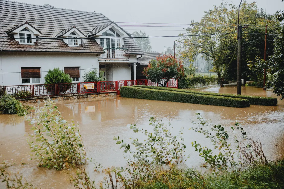
The paradox of heavy rain failing to ease drought is well understood in hydrology. After prolonged dry spells, soil becomes compacted and water-repellent (hydrophobic), which sharply reduces how much water can soak in. The Met Office explicitly warned that intense showers could cause surface water flooding as rain falls on very dry and hard ground. Deputy chief forecaster Mike Silverstone told PA Media that Thursday of that week would bring heavy showers across much of the country, with the outlook also forecasting thunder showers for Thursday and Friday before brighter, drier conditions on Saturday. (The Guardian)
The rainfall deficit is substantial. Liz Stephens, professor in climate risk and resilience at the University of Reading, said the south-east of England was still a month's worth of rain below normal for that point in the year. Environment Agency data showed five of England's key reservoirs were "exceptionally low" as of 14 August 2026. The agency had already introduced formal spray irrigation bans — restrictions on farmers using water from rivers and groundwater to irrigate crops — and in the week of 7 to 13 August, over 1,500 abstraction restrictions (limits on taking water from natural sources) were in place across the country. (GOV.UK)
The drought's trajectory has been steep. As of 10 August, 71.3% of England was in drought following a record dry July. The Environment Agency said conditions worsened further after a dry start to August. Reuters reported that Britain described more than 70% of the country as experiencing flash drought conditions — rapid-onset droughts driven by short-term rainfall deficits and high temperatures — and that UK officials planned to meet to discuss how to cope with the deepening crisis. (GOV.UK; Reuters)
South East Water, which became the first water company to issue a hosepipe ban in summer 2026 when it barred customers in parts of Kent from using them on 3 July, is facing intensifying pressure over its operational response. A Department for Environment, Food and Rural Affairs spokesperson said South East Water needed to "go further and faster to reduce leaks and follow its drought plans." The company's essential-use-only instruction to Kent customers came after the supply failure that left around 8,000 properties without water. (The Guardian)
Wessex Water's hosepipe ban broadens the geographic footprint of mandatory water-use limitations well beyond the initial Kent-focused measures. The company had not imposed such restrictions in half a century. The ban extends across four counties and affects 1.4 million customers. (The Guardian)
The Met Office's warning framework provides context for how the public should interpret flood risk in the coming days. A red weather warning means dangerous weather is expected, with a very likely risk to life, substantial disruption to travel and energy supplies, and possible widespread damage to property and infrastructure. An amber warning indicates an increased likelihood of impacts from severe weather, including possible travel delays, road and rail closures, power cuts, and potential risk to life and property. A yellow warning covers a range of weather situations and requires the warning content to be read for specifics. As of 18 August, the Met Office's UK weather warnings page listed no warnings for the week of 18–24 August and displayed a notice that warnings "may be out of date" due to technical issues being experienced. (Met Office)
Separately, the Met Office issued flood warnings for North East England in August 2026, with a band of rain pushing through overnight followed by showers. (Met Office Regional)
The broader context here is one of compounding water-stress indicators converging simultaneously. Reservoir levels at "exceptionally low" status, over 1,500 abstraction restrictions, formal spray irrigation bans, hosepipe prohibitions spreading to new regions, and supply failures affecting thousands of households are not discrete events but a cascading sequence. The technical reality is that intense convective rainfall on baked, impermeable soils generates runoff rather than recharge, meaning the drought's hydrological recovery will lag behind any meteorological improvement by weeks or months. Reservoirs and aquifers (underground water stores) require sustained, moderate rainfall over extended periods to recover; flash downpours, however voluminous, do not substitute for that slow infiltration. Think of it like pouring a bucket of water onto a dry sponge that has hardened — most of it splashes off rather than soaking in.
The Met Office warnings-page degradation adds a layer of operational risk. With the public-facing warnings portal displaying a notice about potential inaccuracy during a period when surface water flooding is explicitly forecast, the reliability of real-time risk communication to affected populations is in question at a consequential moment.