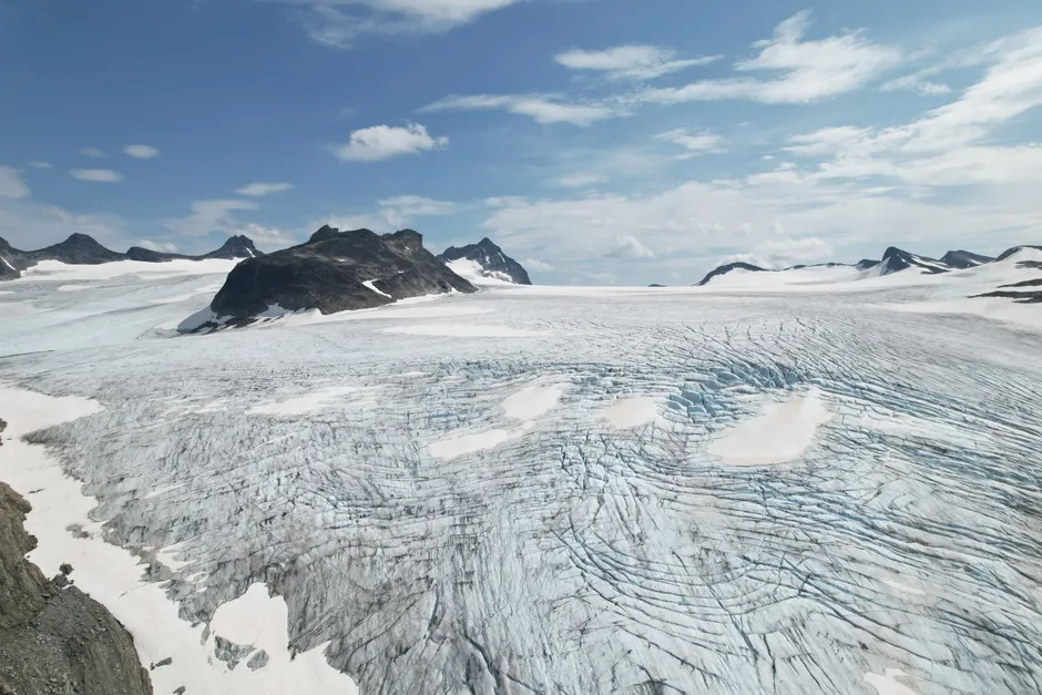
Glacier Collapse Triggers Catastrophic Floods on the Nepal-Tibet Border

A glacier collapse in the Himalayas on 26 August 2026 triggered catastrophic flooding along the Nepal-Tibet border, killing more than 270 people and leaving at least 1,300 missing across Nepal and China's Tibet region as of 27 August 2026. Al Jazeera
The collapse occurred at approximately 8:40am local time (02:55 GMT) when a large section of glacier broke away high above the Lhende river in Tibet, roughly 20 km northeast of the Rasuwagadhi border crossing. The falling ice and rock dammed the river; when the blockage gave way, the surge tore through settlements in Nepal's Rasuwa district, destroying homes, hydropower plants, and border infrastructure. The landslide itself registered as a magnitude 5.2 seismic event. Early reports attributed the collapse to a magnitude 4.4 earthquake, but the United States Geological Survey later determined the seismic signal was generated by the landslide, not a tectonic event.
The human toll climbed steeply over the first 36 hours. Reuters reported 157 bodies recovered on 26 August. Al Jazeera later reported 162 bodies recovered by Nepal Police, with Chinese authorities confirming at least three deaths on their side. By 27 August, the combined figure exceeded 270 confirmed dead. Nepal Police spokesperson Abi Narayan Kafle said the death toll is expected to rise further. Al Jazeera
At least 19 bridges and approximately 40 km of road were destroyed, severely hampering rescue operations. Satellite imagery captured by Planet Labs before and after the flood showed buildings and roads washed away and large parts of Syapru Besi village submerged in mud. Chinese state broadcaster CCTV reported that a mudslide near the Gyirong Port land border crossing left mud averaging more than 1.5 metres deep, with some road sections exceeding 2 metres. The Hindu published drone-view imagery showing mud covering properties in Trishuli, Nuwakot district. The Hindu
The Copernicus Emergency Management Service activated its on-demand mapping service under activation code EMSR927 for the flood in Nepal, recording the event time as the night of 25 August 2026 (UTC) and the activation time as 26 August 2026 at 09:53 UTC, classifying the event as a flash flood.
The casualty trajectory across reporting cycles illustrates the operational reality of Himalayan disasters. Initial reports from The Weather Channel on 26 August cited at least 98 dead and hundreds missing. GMA News subsequently reported more than 150 confirmed dead. The New York Times placed the figure at 160 killed. The most recent Al Jazeera reporting on 27 August consolidated the toll at over 270 dead and 1,300 missing across both sides of the border. Each successive figure reflected not only elapsed search time but also the gradual restoration of communication with cut-off valleys. The Weather Channel
The mechanics of this event follow a documented pattern in high-altitude glacial environments. When a glacier segment detaches, the resulting ice-rock avalanche can travel at velocities sufficient to dam a river channel on impact. Think of it as a plug: the debris blocks the river, water pools behind it, and when the plug fails, all that water rushes downstream at once. The lag between dam formation and breach can range from minutes to hours, offering a narrow window for downstream evacuation if monitoring systems detect the obstruction in time. In this case, the collapse site in Tibet fed directly into Nepal's Rasuwa district, giving communities downstream minimal lead time.
The destruction of hydropower infrastructure along the Bhote Koshi and Trishuli river systems carries implications beyond the immediate humanitarian crisis. Nepal's border-district hydropower installations serve both domestic supply and export arrangements with India, and damage assessments will likely shape energy planning conversations in Kathmandu for months. The loss of 19 bridges along the Rasuwagadhi corridor, a trade route linking Nepal and China, also disrupts overland commerce through one of the few functional border crossings between the two countries.
The broader context here is the accelerating frequency of glacial-hydrological hazards across the Hindu Kush-Himalayan system. Warming at high elevations destabilizes both glacier structure and permafrost, increasing the probability of detachment events and the formation of glacial lakes prone to outburst floods. The 2021 Chamoli disaster in Uttarakhand, India, which killed over 200 people, followed a broadly similar mechanism: a rock-ice avalanche generated a flood surge downstream with no meaningful warning. The Nepal-Tibet event reiterates that transboundary river basins in the Himalayas face compounding risks where upstream geomorphological events in one country produce lethal consequences in another, and where the affected corridors host critical infrastructure rather than empty terrain.
For rescue and recovery, the outlook remains constrained by terrain and continued access difficulties. With roads severed and bridges gone, helicopters and foot patrols are the primary means of reaching cut-off communities. The missing count, which exceeds the confirmed dead by a factor of nearly five, suggests that the final casualty figures will be substantially higher once search teams reach upstream settlements and the mud and debris recede enough for recovery operations.