Europe's 2026 Wildfire Crisis: Three Firefighters Dead, Thousands Evacuated Across Spain, France, and Italy

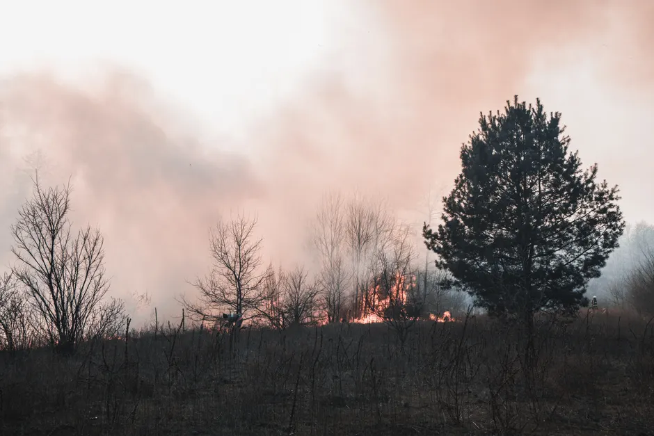
Wildfires burning across Spain, France, and Italy have killed three firefighters and forced thousands of evacuations as of July 23, 2026 (France 24). Fires are actively spreading across southwestern France, central Spain, and Sicily. So far in 2026, wildfires have burned more land in Europe than the annual average over the past two decades (Deutsche Welle).
Satellite imagery from the Copernicus Sentinel-2 mission captured smoke rising from a wildfire in Castilla-La Mancha, Spain, on July 21, 2026 (Reuters Connect). Reuters satellite imagery also showed smoke and flames from wildfires rising above areas in France, Portugal, and Spain, alongside burned areas of land (Reuters). The previous week, over 1,000 people were evacuated due to a wildfire in Spain as of July 17, 2026 (Reuters).
Spain's meteorological agency, AEMET, anticipated a new heat wave for Spain around July 22, 2026 (El Observador). On that date, Madrid experienced an unusual sky colour attributed to a combination of the heatwave, calima (Saharan dust carried north by wind), and wildfires, resulting in severely degraded air quality (El Observador). AEMET also maintained active marine weather warnings for the Costa de Valencia y Murcia region, valid until Saturday, July 25, 2026 (AEMET).
The European Commission's Joint Research Centre reported that very extreme fire danger conditions dominated southwestern France and extended into northern Spain (European Commission Joint Research Centre). Additional pockets of very extreme fire danger were present across Portugal, the British Isles, and Ireland (European Commission Joint Research Centre). Météo-France stated on July 23, 2026, that 9 out of 10 wildfires are of human origin (Météo-France).
The Copernicus Atmosphere Monitoring Service (CAMS) forecasts showed increased fine particulate matter (PM2.5) concentrations across the Iberian Peninsula with severely degraded air quality (Copernicus Atmosphere Monitoring Service). PM2.5 refers to airborne particles smaller than 2.5 micrometres, small enough to penetrate deep into the lungs. Spain went from below-average wildfire emissions to record wildfire emissions in just one week (Copernicus Atmosphere Monitoring Service). Smoke from the Iberian Peninsula wildfires reached France, the United Kingdom, and Scandinavia (Copernicus Atmosphere Monitoring Service). CAMS had monitored wildfire emissions and resulting smoke transport across the Atlantic from both North America and Europe in June and July (Copernicus Atmosphere Monitoring Service).
Earlier in the season, several fires were burning in southern France (Copernicus Atmosphere Monitoring Service). CAMS predicted high fire risk for Spain, France, and the Benelux in the first week of July (Copernicus Atmosphere Monitoring Service). AEMET has implemented a new fire danger index called IPIF (Índice de Peligro de Incendios) to assess conditions (AEMET).
The broader context here involves the intersection of compounding meteorological hazards and their downstream atmospheric impacts. The rapid escalation in Spain from below-average to record wildfire emissions within a single week illustrates how quickly dry vegetation can ignite under sustained heat and arid conditions. Think of a forest after weeks of drought as a matchstick waiting for a spark; once ignited, the fire feeds on the accumulated fuel faster than agencies can contain it.
The transboundary transport of PM2.5 to France, the United Kingdom, and Scandinavia means the public health and air quality consequences of Iberian wildfires are not geographically confined. When Saharan dust events coincide with local fire emissions and a heatwave, the resulting air quality degradation becomes a multi-layered atmospheric hazard, stacking different pollutants on top of each other.
The scale of land burned in 2026 exceeding the two-decade annual average across Europe suggests a shifting baseline for fire seasons. With very extreme fire danger conditions present from southwestern France through Portugal and into the British Isles, the geographic footprint of risk is widening. The assertion by Météo-France that human activity drives 90 percent of wildfire ignitions places a heavy operational emphasis on prevention and land management. As fire agencies rely on updated indices like Spain's IPIF to forecast danger, atmospheric monitoring services continue to track the hemispheric movement of smoke. The atmospheric and terrestrial data indicates that fire management is now a cross-border infrastructure challenge.