Colombia Earthquake: What Happened and Why the Damage Spread So Wide

A 7.4-magnitude earthquake struck western Colombia on August 10, 2026, killing at least 20 people, collapsing buildings across several cities, and triggering a national emergency response focused on the hard-hit Chocó region. The quake, which struck at 12:34 UTC at a depth of 107 km (66 miles), was felt across Colombia and into neighbouring Ecuador.
The US Geological Survey placed the epicentre 5 km east of San José del Palmar, a municipality in Colombia's Chocó department roughly 400 km west of Bogotá. Colombia's geological service, the Servicio Geológico Colombiano (SGC), initially estimated the magnitude at 6.6 before revising it upward; the SGC's historical seismicity database records the event at magnitude 7.37. The US tsunami warning system said no tsunami advisory was issued.
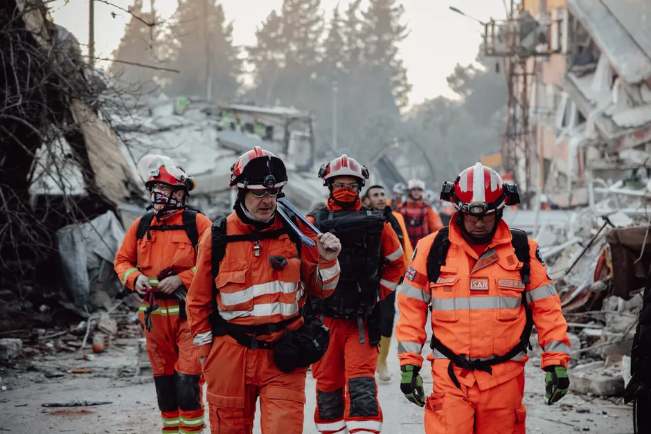
The toll was concentrated in the Coffee Triangle and the Valle del Cauca. In Pereira, 18 people were killed and others remained trapped in collapsed buildings, mayor Mauricio Salazar told Caracol Radio. In Manizales, two people were killed, mayor Jorge Eduardo Rojas Giraldo confirmed in an interview with Blu Radio. Rojas said more than 12 buildings and 20 homes had been partially or completely destroyed in that city, and he urged residents to stay outdoors because of aftershock risk — the smaller tremors that follow a main quake, which can cause already-damaged structures to give way. One of the towers of Manizales's neo-Gothic cathedral collapsed onto the nave.
In Cali, mayor Alejandro Eder said at least 20 buildings had collapsed, with residents trapped in at least 19 of them. Cali requested additional rescue teams from Bogotá and Medellín to supplement local capacity. Footage shared by local media showed homes and small buildings collapsing in Pereira, Cali, and Quibdó. Chocó governor Nubia Córdoba reported injuries and serious structural damage in the regional capital, though she did not provide further details. Six airports damaged in the quake suspended operations, and AFP reporters observed building evacuations in Bogotá.
President Abelardo de la Espriella said he would personally supervise recovery efforts and install an emergency centre in San José del Palmar. The emergency response is still unfolding; the death toll is a preliminary figure and may rise as search-and-rescue operations continue in collapsed structures across several cities.
The broader context here is Colombia's acute seismic exposure and the regional pattern of major events in 2026. The country sits along the eastern edge of the Nazca Plate as it slides, or "subducts," beneath the South American Plate. Think of two enormous pieces of the Earth's crust colliding, with one diving beneath the other — that collision zone makes western Colombia among the most seismically active areas on the continent. The August event invites comparison with two recent catastrophes. In late June 2026, back-to-back 7.2 and 7.5 magnitude earthquakes struck Venezuela, destroying hundreds of buildings; the death toll from those events has since surpassed 6,000. In 1999, a 6.2 magnitude earthquake near the Colombian city of Armenia killed more than 1,100 people, a disaster that prompted reforms to building codes and emergency management protocols. The fact that the August 10 quake, at a higher magnitude than Armenia, produced a lower initial death toll may reflect those structural improvements, though the 107 km focal depth also reduced surface shaking compared with a shallow event. The collapse of the Manizales cathedral tower, however, illustrates the particular vulnerability of heritage structures that were never reinforced to meet modern seismic standards.
The relatively deep hypocentre — the underground point where a quake originates — is worth noting for what it means on the ground. Intermediate-depth earthquakes at roughly 100 km distribute their energy over a wider area, which is why the event was felt as far as Bogotá and Ecuador but did not generate a tsunami. That same dispersion can produce moderate-to-strong shaking across a broad populated corridor rather than catastrophic intensity in a single zone, which is consistent with the pattern of damage spread across Pereira, Manizales, Cali, and Quibdó rather than concentrated solely at the epicentre. The trade-off is operational: rescue and assessment resources must be distributed across a wide geographic footprint, complicating logistics for a response that Cali's mayor has already sought to supplement with teams from two other cities.