Colombia Earthquake: A Major Quake Tests a New Government and a Region Already on Edge

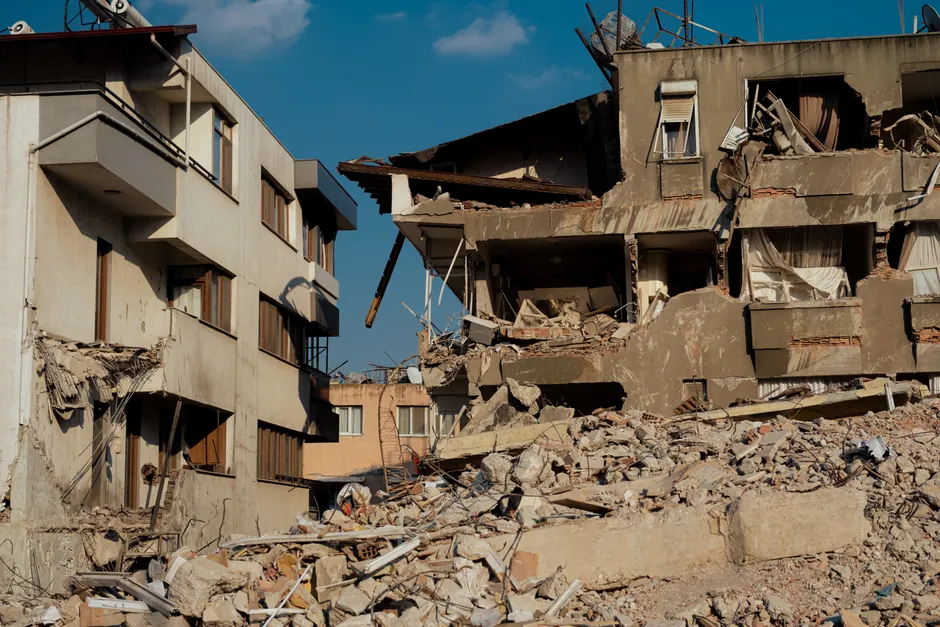
A 7.4-magnitude earthquake struck western Colombia at 7:34 a.m. local time on Monday, 10 August 2026, killing more than 70 people across several departments and causing widespread damage to buildings, homes, and at least six airports in the country's coffee-growing and Pacific coastal regions.
The epicenter was located 5 km east of San José del Palmar, in the western department of Chocó, according to the U.S. Geological Survey, which assigned the event ID us6000tjl2. The Servicio Geológico Colombiano (SGC), Colombia's national geological service, independently listed the earthquake on its seismicity portal, also placing it at San José del Palmar. Both agencies reported the same magnitude and timing. The tremor was felt as far away as neighbouring Venezuela. The Guardian
Colombia's western Andean corridor bore the brunt. Authorities reported 27 deaths in Valle del Cauca department, where Cali mayor Alejandro Eder said at least 20 buildings had collapsed and some people were trapped inside. In Pereira, the capital of Risaralda department, 18 deaths were reported. The newspaper El Espectador, citing government officials, reported at least 72 people killed nationwide, 40 of them in Risaralda. At least two deaths were confirmed in Manizales, the capital of Caldas department. The Guardian
The toll across the three departments of the Eje Cafetero (coffee axis) and Valle del Cauca reflects the density of mid-size cities built along active fault systems in Colombia's western mountain range, or cordillera. Pereira, Manizales, and Cali all sit in the Cauca Valley and Central Andes corridor, a region with a documented history of seismic events. Building quality there varies widely, meaning some structures can withstand strong shaking while others cannot.
Manizales mayor Jorge Eduardo Rojas Giraldo said at least 12 buildings and 20 homes there had been partially or completely destroyed, and warned citizens to be ready for aftershocks, the smaller tremors that follow a main earthquake, and not to re-enter buildings. The cathedral of Manizales was also damaged. In Chocó's capital, Quibdó, Governor Nubia Carolina Córdoba reported injuries and severe structural damage. The Guardian
Colombian aviation authorities said the airports in Pereira, Manizales, Quibdó, Cartago, Armenia, and Buenaventura had sustained damage. The affected airfields span roughly 250 km from the Chocó lowlands near the Caribbean through the central Andean valleys, which complicates logistics for any emergency relief airlift. Buenaventura, on the Pacific coast, is Colombia's principal Pacific port, and damage to its airport could affect supply chains for the region.
Colombia's president, Abelardo de la Espriella, who took office on Friday, 8 August, flew to Bogotá to personally lead the government's earthquake response. The timing places the disaster squarely in the first days of a new administration, before ministerial appointments and emergency-response protocols are fully in place. U.S. Secretary of State Marco Rubio said the Trump administration was closely monitoring the situation and stood ready to offer support. The Guardian
The quake follows another catastrophic seismic event in the broader region: twin earthquakes struck Venezuela's northern coast on 24 June 2026, killing more than 6,000 people. That disaster, just seven weeks earlier, would have already placed regional emergency management and humanitarian agencies on heightened alert. The Colombian event, while far less lethal, strains those same response networks. The proximity of the two events raises questions about whether the northern Andes and Caribbean plate-boundary zone is in a period of heightened seismic release.
The two events, however, occurred on different tectonic systems. The Venezuelan quakes struck along the Caribbean–South American plate boundary on the northern coast. The Colombian event happened in the complex collision zone of the Nazca, South American, and Caribbean plates in the western cordillera. Think of it this way: the Earth's crust is made up of massive rocky slabs called tectonic plates that are constantly, slowly moving. Where these plates meet and grind against each other, pressure builds up over years or decades. When that pressure is suddenly released, you get an earthquake.
The broader context here is that Colombia's western Andes sit above one of the most seismically active zones in the Western Hemisphere, where the Nazca plate subducts, or dives beneath, the South American plate. A 7.4-magnitude event is major by any classification: it can cause serious damage to well-built structures and catastrophic damage to poorly engineered ones, particularly in cities with mixed building stock like Manizales, Pereira, and Cali.
The discrepancy between the initial death counts reported by individual mayors and the higher aggregate figure cited by El Espectador points to the early stage of casualty accounting. In major earthquakes, confirmed deaths typically rise over the first 24 to 48 hours as collapsed structures are cleared and access is restored to remote areas. Chocó, where the epicenter is located, is among Colombia's most geographically isolated and least infrastructure-connected regions. Full assessment of damage there is likely to lag behind the more accessible Andean cities.