Magnitude 7.4 Earthquake Strikes Western Colombia: What Happened and What Comes Next

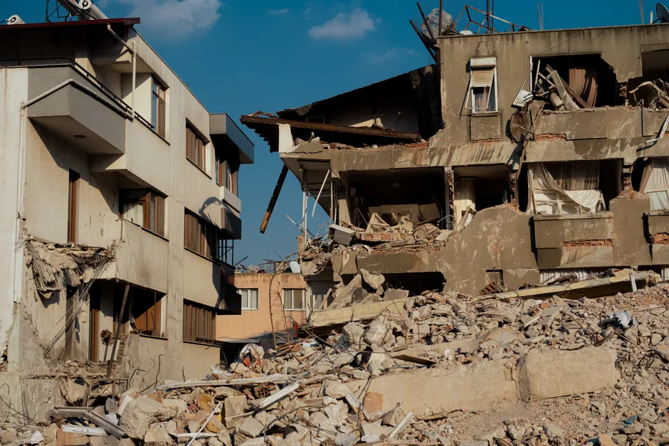
A magnitude 7.4 earthquake struck western Colombia on the morning of 10 August 2026, killing at least 77 people and causing serious structural damage, including building collapses with civilians trapped inside (Reuters). The quake, recorded at 7:34 a.m. local time, was felt across a wide swath of the country, shaking the capital Bogotá roughly 250 miles from the epicenter (NBC News).
The U.S. Geological Survey placed the epicenter near San Jose del Palmar in the department of Chocó, at a depth of 107 km (66 miles). That depth classifies it as an intermediate-depth earthquake — meaning the rupture occurred well below the surface, deep enough to reduce the sharpest ground shaking near the epicenter but wide enough in reach that the tremor traveled efficiently through the crust, reaching cities like Bogotá and Cali (Reuters). Colombia's national disaster management agency, the Unidad Nacional para la Gestión del Riesgo de Desastres (UNGRD), issued a bulletin from Bogotá confirming the magnitude and time of the event (UNGRD).
Casualty figures remain in flux across wire services. Reuters reported at least 77 fatalities, while The New York Times documented a death toll of at least 69 as of its reporting on 10 August 2026 (The New York Times). NBC News corroborated reports of serious damage and individuals trapped in collapsed structures, though it did not specify a fatality count. Given the standard reporting cycle for mass-casualty natural disasters, these early tallies should be treated as provisional.
Colombian President Abelardo De La Espriella announced he had taken direct leadership of the emergency response (Reuters Connect). Centralizing federal command over disaster management allows the executive to bypass standard departmental coordination bottlenecks, speeding the deployment of military and civil-defense assets to Chocó and surrounding affected departments. This move also places the political liability for rescue and recovery operations directly on the presidency.
The broader context here involves Colombia's high seismicity, driven by the interaction of three tectonic plates — the Nazca, South American, and Caribbean plates — whose grinding movements make the region one of the most earthquake-prone in the world. The Servicio Geológico Colombiano (SGC) operates the Colombian National Seismological Network, monitoring constant tectonic activity across the Andean belt. The 10 August event is the most destructive seismic event in the country since a magnitude 6.1 earthquake struck on 17 August 2023, located 10 km east of El Calvario, Meta, at a shallow depth of less than 30 km (SGC). The SGC published a detailed report on that event's aftershocks the following day, establishing a baseline for the type of seismic sequence monitoring expected in the wake of the current disaster (SGC).
Intermediate-depth earthquakes like the 10 August event release energy far underground. The 107 km depth reduces surface ground motion intensity compared to shallow events of the same magnitude, but it allows seismic waves to propagate efficiently through the crust, explaining why the tremor was felt in Bogotá and Cali. The structural vulnerabilities of older buildings in western Colombian municipalities, combined with the region's topography, complicate initial damage assessments.
Prior to the mainshock, the SGC's monitoring systems recorded several smaller regional events in August 2026. The agency's earthquake tracker lists a quake with an epicenter in Briceño, Boyacá, and another in Choachí, Cundinamarca, with an origin time of 16:39 local time (21:39 UTC) on 7 August 2026, at coordinates 4.62°N, 73.82°W (SGC). On that same day at 9:11 PM local time, the SGC recorded a magnitude 4.3 earthquake with a depth of 8 km and a maximum intensity of 5, with an epicenter in Cumbal, Nariño (SGC). These events are part of the routine tectonic background of the region and should not be treated as foreshocks of the larger event, but rather as background context for the ongoing seismicity the agency monitors.
Looking at what this means for the immediate future, recovery operations will likely focus on the western departments closest to the epicenter. The intermediate depth may have reduced absolute surface destruction in the immediate vicinity of San Jose del Palmar, but it broadened the affected zone, spreading damage across a wider geographic area than a shallow event would have. This complicates logistics for the UNGRD and military responders, who must route aid across difficult Andean terrain to dispersed populations rather than a single concentrated ground zero. The coming days will test the De La Espriella administration's capacity to manage a multi-departmental disaster response while maintaining public confidence in provisional casualty reporting.